Please, could you guide me , I have a problem with the widget Editor (arcgis-JS-API),
I need to loop through all my featurelayers (in my map), to apply the Editor widget "esri/widgets/Editor", to the layers in my map (uploaded from Arcgis server online), because I need to add (edit, delete, update capibilities to my featurelayers in the same document) : could you please guide me, here you find my code, I have this error message, when I run it
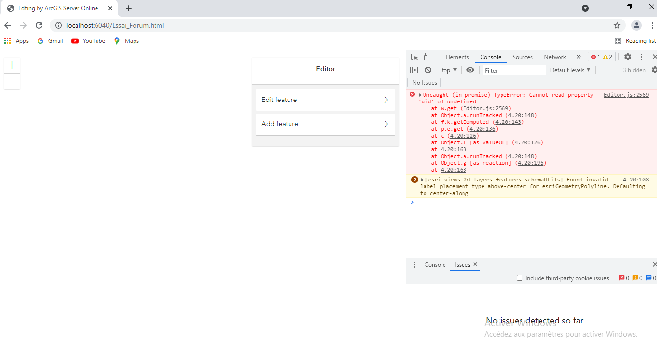
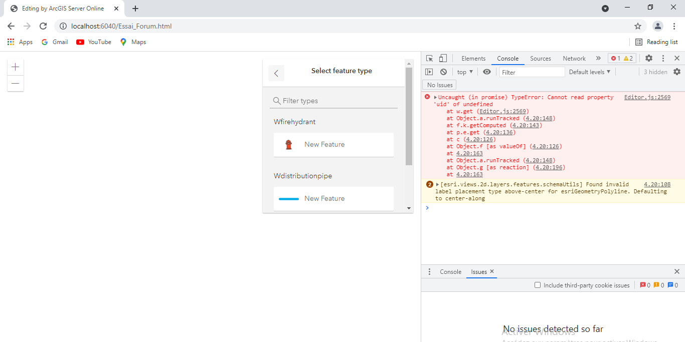
The error message: (you find the screenshots, below, after the code)
Uncaught (in promise) TypeError: Cannot read property 'uid' of undefined
at w.get (Editor.js:2569)
at Object.a.runTracked ((index):148)
at f.k.getComputed ((index):143)
at p.e.get ((index):136)
at c ((index):126)
at Object.f [as valueOf] ((index):126)
at (index):163
at Object.a.runTracked ((index):148)
at c.u [as _notify] ((index):196)
at c.g.onCommitted ((index):198)
And here the code:
<html lang="en">
<head>
    <meta charset="UTF-8">
    <meta name="viewport" content="width=device-width, initial-scale=1.0">
    <meta http-equiv="X-UA-Compatible" content="ie=edge">
    <link rel="stylesheet" href="https://js.arcgis.com/4.20/esri/themes/light/main.css">
    <script src="https://js.arcgis.com/4.20"></script>
    <title>Edting by ArcGIS Server Online</title>
    <style>
        html,
        body,
        #viewview {
            padding: 0px;
            margin: 0px;
            height: 100%;
            width: 100%;
        }        #formDiv {
            width: 100%;
        }        .esri-item-list__scroller {
            overflow-y: visible;
        }        .list-heading {
            font-weight: normal;
            margin-top: 20px;
            margin-bottom: 10px;
            color: #323232;
        }        .or-wrap {
            background-color:white;
            height: 1px;
            margin: 2em 0;
            overflow: visible;
        }        .or-text {
            background:white;
            line-height: 0;
            padding: 0 1em;
            position: relative;
            bottom: 0.75em;
        }    </style>
</head>
<body>
    <script>
        let map;
        let view;
        let pointLayer, lineLayer, polygonLayer;
        require(["esri/Map",
                "esri/views/MapView",
                "esri/layers/FeatureLayer",
                "esri/widgets/Editor",
                "dojo/domReady!"
            ],
            function(Map,
                MapView,
                FeatureLayer,
                Editor            ) {                // wfirehydrant
                let wfirehydrantSymbol = {
                    type: "simple",
                    symbol: {
                        type: "picture-marker",
                        url: "https://img.icons8.com/doodle/48/000000/fire-hydrant--v1.png",
                        width: "20px",
                        height: "20px"
                    }
                }                let wfirehydrantPopup = {
                        "title": "wfirehydrant",
                        "content": "<br>FID:</br> {FID} <br>z:</br> {z}"
                    }                // distrution pipe
                let wdistributionpipeSymbol = {
                    type: "simple",
                    symbol: {
                        type: "simple-line",
                        cap: "round",
                        color: [0,172,230],
                        width: "5px",
                        style: "solid"
                    }
                }
                let wdistributionpipeLabel = {
                    symbol: {
                        type: "text",
                        color: "black",
                        haloColor: "white",
                        haloSize: "1.5px",
                        font: {
                            size: "13px",
                            family: "Noto sans",
                            style: "italic",
                            weight: "normal"
                        }                    },
                    labelPlacement: "above-center",
                    labelExpressionInfo: {
                        expression: "$feature.Shape__Length"
                    }
                }
                let wdistributionpipePopup = {
                    "title": "wdistributionpipe",
                    "content": "<br>Materal:</br> {MATERIAL_E} <br>CITYENAME:</br> {CITYENAME}"
                }                // transmission pipe
                let wtransmissionPipeSymbol = {
                    type: "simple",
                    symbol: {
                        type: "simple-line",
                        cap: "round",
                        color: [0, 0, 230],
                        width: "5px",
                        style: "solid"
                    }
                }
                let wtransmissionPipeLabel = {
                    symbol: {
                        type: "text",
                        color: "black",
                        haloColor: "white",
                        haloSize: "1.5px",
                        font: {
                            size: "13px",
                            family: "Noto sans",
                            style: "italic",
                            weight: "normal"
                        }                    },
                    labelPlacement: "above-center",
                    labelExpressionInfo: {
                        expression: "$feature.Shape__Length"
                    }
                }
                let wtransmissionPipePopup = {
                    "title": "WTransmissionPipe",
                    "content": "<br>Materal:</br> {MATERIAL_E} <br>CITYENAME:</br> {CITYENAME}"
                }
                const wtransmissionPipe = new FeatureLayer({
                    url: "https://services3.arcgis.com/0G16ZDbXMbWFq4Wr/arcgis/rest/services/wtransmissionpipe/FeatureServer/0",
                    outFiels: ["*"],
                    popupEnabled: true,
                    id: "WTransmissionPipe",
                    renderer: wtransmissionPipeSymbol,
                    labelingInfo: [wtransmissionPipeLabel],
                    popupTemplate: wtransmissionPipePopup
                });                const wdistributionpipe = new FeatureLayer({
                    url: "https://services3.arcgis.com/0G16ZDbXMbWFq4Wr/arcgis/rest/services/wdistributionpipe/FeatureServer/0",
                    outFiels: ["*"],
                    popupEnabled: true,
                    id: "wdistributionpipe",
                    renderer: wdistributionpipeSymbol,
                    labelingInfo: [wdistributionpipeLabel],
                    popupTemplate: wdistributionpipePopup
                })                const wfirehydrant = new FeatureLayer({
                    url: "https://services3.arcgis.com/0G16ZDbXMbWFq4Wr/arcgis/rest/services/wfirehydrant/FeatureServer/0",
                    outFiels: ["*"],
                    popupEnabled: true,
                    id: "wfirehydrant",
                    renderer: wfirehydrantSymbol,
                    outFiels: ["FID", "Z"],
                    popupTemplate: wfirehydrantPopup
                })                map = new Map({
                    basemap: "osm",
                    layers: [wtransmissionPipe, wdistributionpipe,
                         wfirehydrant
                    ]
                });
                view = new MapView({
                    container: "viewview",
                    map: map,
                    center: [43.902257, 26.38444],
                    zoom: 15
                });                view.map.allLayers.forEach((layer) => {
                if (layer.type == 'feature') {
                    switch (layer.geometryType) {                        case "polyline":
                            lineLayer = layer;
                            break;
                        case "point":
                            pointLayer = layer;
                            break;
                    }
                }            });           const pointInfos = {
                  layer: pointLayer,
                    fieldConfig: [{
                         name: "Z",
                         label: "Elevation"
                     }, {
                          name: "X",
                          label: "LONGITUDE"
                     }]
                 };            const lineInfos = {
                     layer: lineLayer,
                     fieldConfig: [{
                         name: "Shape__Length",
                         label: "Length"
                     }, {
                         name: "CITYNAME",
                         label: "CITY NAME"
                    }]
                  };            const editor = new Editor({
                    view: view,                    layerInfos: [{
                        layer: pointLayer,
                        fieldConfig: [pointInfos]
                    }, {
                        layer: lineLayer,
                        fieldConfig: [lineInfos]
                    }, ],                    snappingOptions: {
                        enabled: true,
                        selfEnabled: true,
                        featureEnabled: true,
                        featureSources: [{
                            layer: pointLayer
                        }, {
                            layer: lineLayer
                        }]
                    }
                });                view.ui.add(editor, "top-right");            });    </script>    <div id="viewview"></div>
    <div id="editDiv"></div>
</body></html>
here the screenshots