I am having an issue with my labels in AGOL/Web Map (using the new Map Viewer).
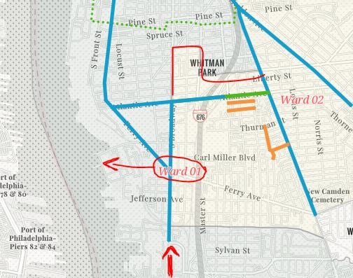
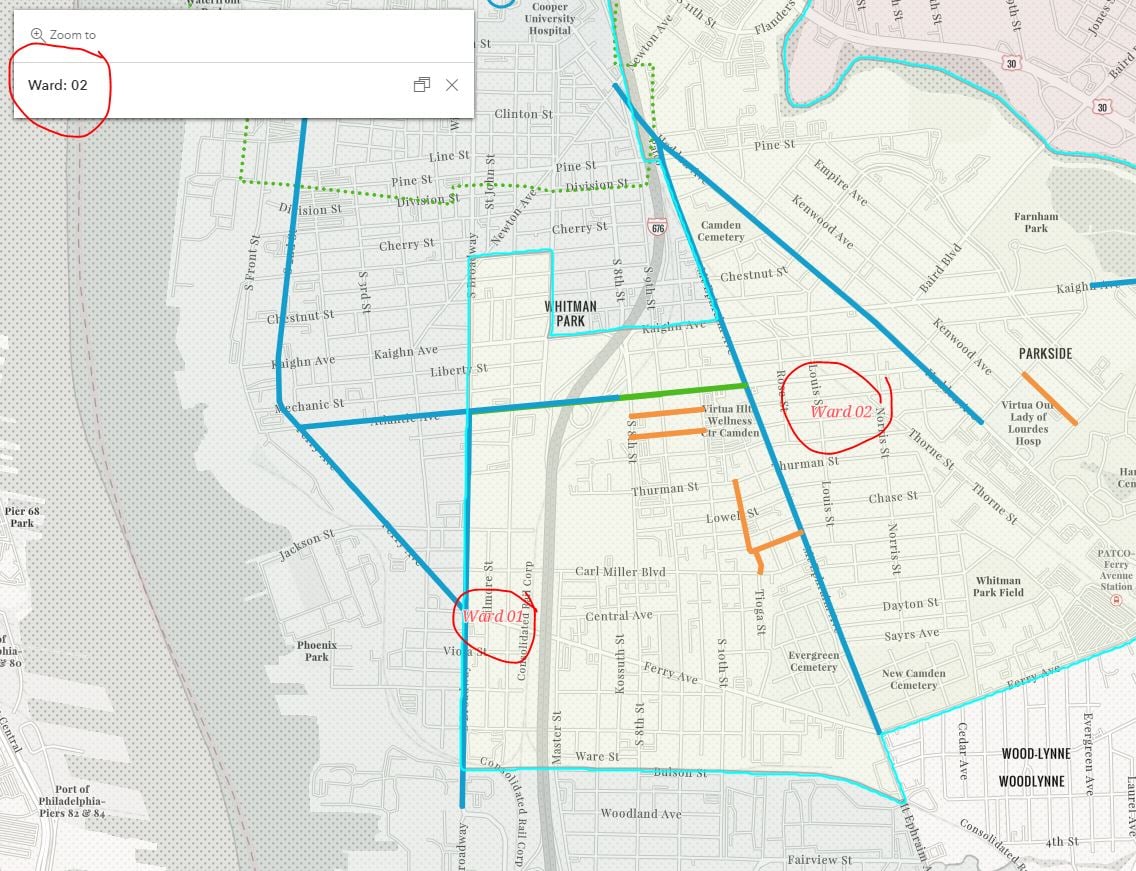
See screenshots below.
I have a Wards layer, where the "Ward 01" label is sitting right on the boundary of Wards 1 & 2. I drew an arrow and red line where the boundary line is, so you can see for reference. In the second screenshot, you can see the label still doesn't move off of the boundary when zoomed in. I've selected Ward 2 so you can see that the label for Ward 1 is within the boundary.
How can I fix this? There's not many configuration options at all for labels.
The other three ward labels are placed perfectly.
Thank you!