Hi, I have 4000 points features that I am looking for a way to calculate the contributing area for separately. These are representing drains in the urban water system on the mainland. Hence, overlapping polygons are and an independent calculation of the watershed for each point is what I am looking for.
The watershed tool alone provide me with the wrong answer and I have tried approaching with a small model which I have pasted below.
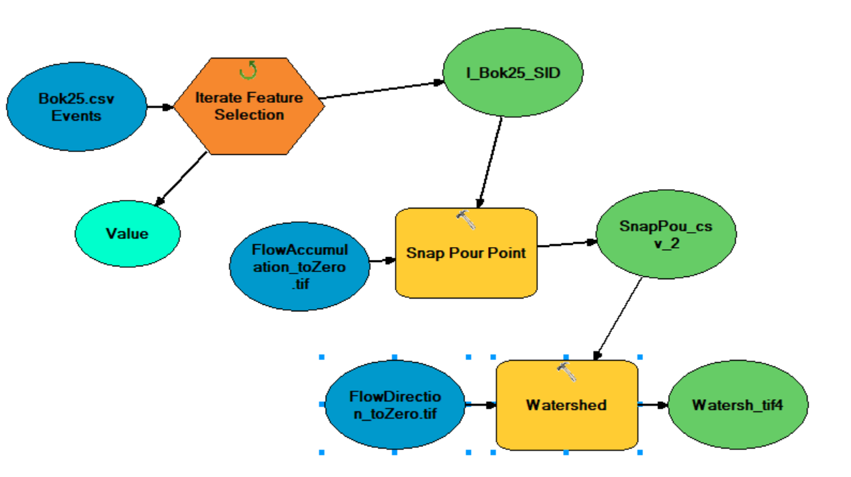
Bok25.csv is essentially a list of of 4000 street drains containing an ID number and the coordinates. My problem with running this model is that all 4000 points are snapped for each iteration (I think) and that the file is overwritten each time. What I am looking for is a way to run the "for loop" below 4000 times:
1) Select only one point from the list
2) Snap only one point to a highly accumulated cell within 1 m distance
3) Calculate the contributing area for that one point
4) Store the value of contributing area in a list or .shp with the ID so I can identify which drain has what contributing area.
Would also be very convenient if the loop stores all polygons or values in one list or shp so I dont have 4000 separate files.
I am using ArcMap 10.8.1 desktop application. Is there a way to do this? I have been browsing around the forum for a while and could not find anything. I also contacted reddit with no luck.
All help is much appreciated as I have spent many hours trying to figure this out. I am new to ArcMap and just recently noticed the model builder. Other input on methods such as toolboxes to acheive my goal is also much appreciated.
Wish you all a good day. Hopefully I am in the right thread.
Kind regards,
Frustrated master student 😉

