Hello everyone, and thank you before hand for your help!
I am trying to calculate raster files in map algebra to compose a final map for the area and I have 4 different raster files (with the classification from 0 to 3) for land use, ex. roads, rivers, shoreline etc. When I sum the 4 rasters in map algebra I get as a result a raster file with 12 classes and not 4 (from 0 to 3) so they don't overlay.
How can I overcome this problem?
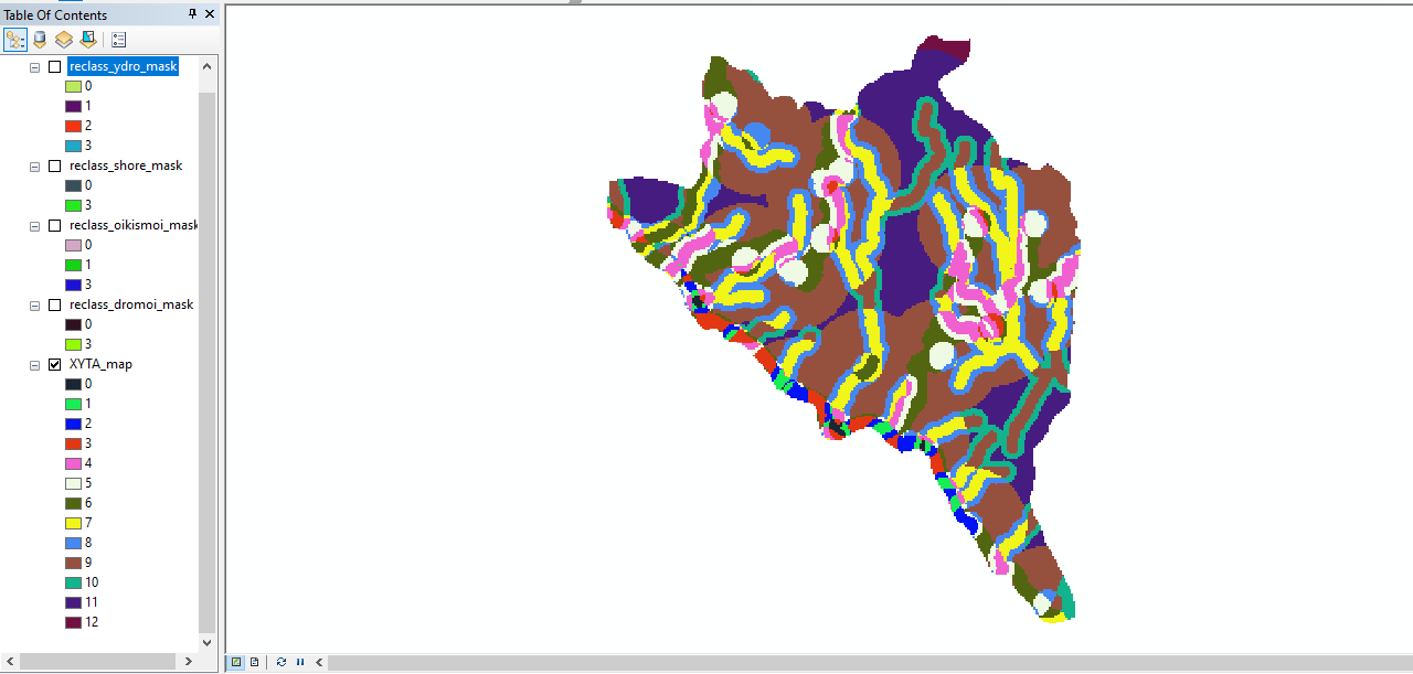
Of course I change the symbology within the final layer to have 4 classes but I am not sure this is the correct way to go...


