Hi Everyone,
I am trying to create a sign plan for a linear project going through a state park and crossing trails. The plan is supposed to show what signs go where to direct trail users in the right direction and should be facing the way a trail user would encounter them in the field. So I created feature classes for each type of sign and have an attribute for rotation to get them lined up with trails. It looks just great in the map. I then created a strip map index feature class and created a map series from it using the angle of the strip map to rotate into the map frame. The problem is that the resulting signs are all facing the wrong direction in the map series now. I have included screenshots in the map that show them facing the correct directions and the same location in the map series showing how they result there.
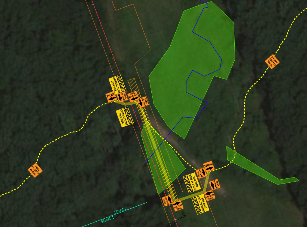
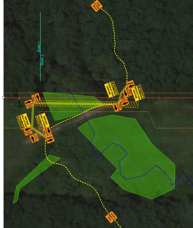
Please help if you know how to fix this rotation issue.
Cheers,
Justin




