ArcGIS Runtime, a family of several APIs for developing native 2D and 3D geo-apps for all relevant platforms, has received another exciting update. Here is an excerpt of the new features:
- Utility Network
- Filter Barriers are now supported. This is useful, for example, in a gas network to stop the trace at a gas leak (Filter Barrier) and find the corresponding valves to shut off the affected gas line.
- ArcGIS Enterprise WebMaps with Utility Network information can now be read and used
- Branch Versioning - it is now possible to set the versions of the feature tables of a Utility Network
- Branch Versioning in Feature Services – there is now session management with options to restrict view and editing access.
- Location API now also supports data sources from high-precision GNSS devices
- Symbology
- Custom CIM Symbols can now also be saved in Webmaps and thus more easily shared in ArcGIS
- Symbols from Web Styles (containers for configurable symbols) can now be used directly in ArcGIS Runtime via an API. Web Styles can also be used offline (currently only in 2D)
- Transparent textures in 3D scenes are now supported, see e.g. City Model Dresden (search for Taschenberg 2)
- Offline capabilities have been refined with some new options
- Feature Tiles can now also be used in 3D
- The use of OGC API Features has been expanded with new functions
- and much more.
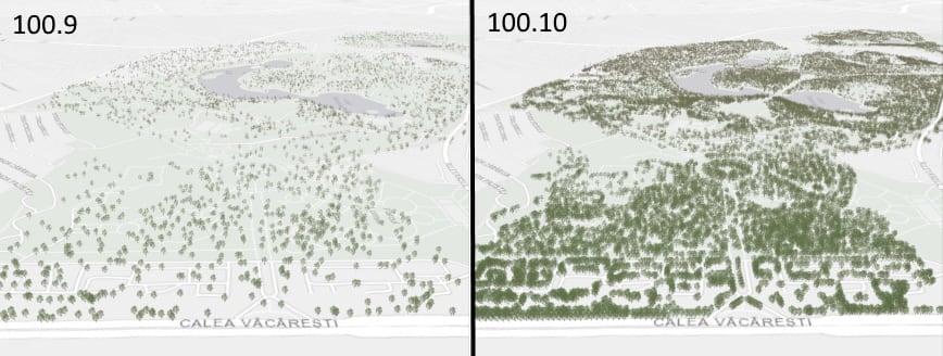
Feature Tiles in 3D – this allows very many features to be displayed in a scene
More information about all the new features in ArcGIS Runtime 100.10 can be found in this Esri Blog and in the release notes of the various SDKs on the ArcGIS for Developers portal.
