The Pattern of Life Link Chart is innovative, because it uses co-location as a "relationship" value:
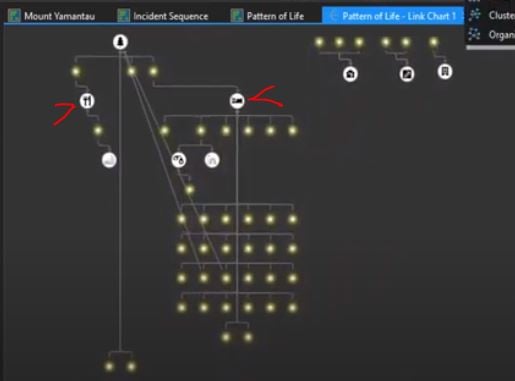
The problem with this tool -- if I understand it right -- is that the analyst must already have a polygon layer of precisely-named locations to make this work. The linkage relies on a simple table join, which requires "location name" values to match precisely. I think this is what's demonstrated at the Esri Defense and Intell Showcase in this clip which I posted on YouTube.
At 7:55 in the video, the analyst specifies the names of the Key Fields for source and target layers. These are required for a simple table join by attribute - matching values in each table:
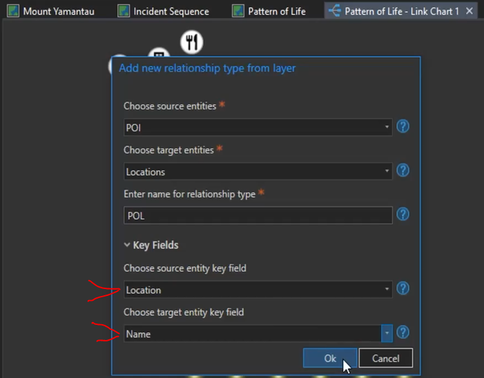
I discussed this with @JamesJones4 at Esri. He indicated that analysts can "add notes" to a location layer (is there a tool for this?) to create that target entity key field for the table join. This seems impossible for the analyst who has lots of data or who does not know in advance which places are important. (This advance knowledge of barracks, guard shack, and mess hall in the Showcase demo seems to be an unlikely scenario for most analysts.)
A better idea?
The input data -- masses of it -- could be run through the Optimized Hot Spot tool to automatically generate the meeting places. (Or use the Find Meeting Places tool?) Use those uniquely identified polygons with a spatial join, not an attribute join as demonstrated, to enumerate all the players who are linked by location.
Or, maybe I'm missing something. I hope so.



