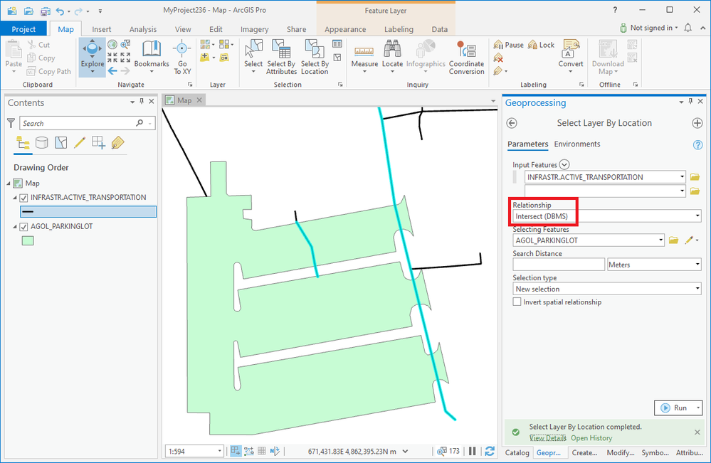
ArcGIS Pro 2.6.8; Oracle 18c 10.7.1 EGDB; SDE.ST_Geometry:
In the Select Layer By Location (Data Management) docs, the Relationship Parameter — Intersect (DBMS) section says:
For the Relationship parameter, the Intersect (DBMS) option may provide better performance than the Intersect option when using enterprise geodatabase data; however, this option is only supported under specific conditions. If all conditions are met, the spatial operation will be performed in the enterprise geodatabase database management system (DBMS) rather than on the client.
...The user connecting to the geodatabase must have privileges to create a view in the database where the feature classes are stored.
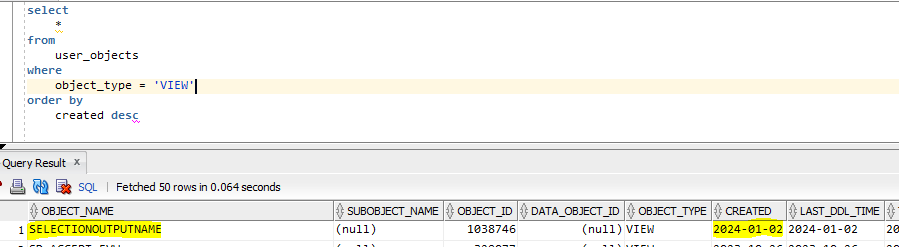
In other words, the tool creates a database view called SELECTIONOUTPUTNAME.
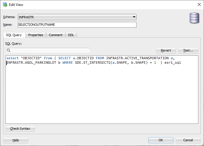
select "OBJECTID" from ( SELECT a.OBJECTID FROM INFRASTR.ACTIVE_TRANSPORTATION a,
INFRASTR.AGOL_PARKINGLOT b WHERE SDE.ST_INTERSECTS(a.SHAPE, b.SHAPE) = 1 ) esri_sql
Question:
What is the intended use case for this technique? I know the docs suggest that the db is sometimes faster than the application, but I find that hard to believe in this particular case. My experience is that spatial queries in the database are way slower than the equivalent spatial operation the the application. In what kinds of scenarios is this technique used?

