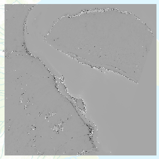
I'm using ArcGIS Pro 2.8.2. I've downloaded Sentinel 2A data, and would like to use raster calculator to calculate EVI. However, my results are outside of the -1 to 1 range, and the image it produces is very strange.
My code is:
2.5*(("B08"-"B04")/(("B08"+6*"B04"-7.5*"B02")+1))where B02 is the blue band, B04 is the red band, and B08 is the NIR band. I based this code off of the general formula given here , which is:
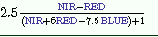
However, when I enter this, I get a range of -18405 to 18220, and my image looks like:
Any advice on why this might be would be greatly appreciated.




