I am looking for a good way to 'fill the gaps' between my county's polygon layer and a land use layer I inherited.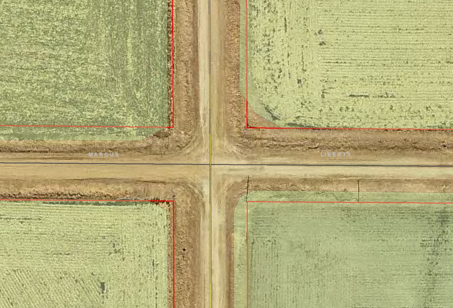
I need the green symbolized land use polygons to, at the very least, overlap the red lined parcel polygons. There are several thousands of this example throughout my county and I would like to avoid correcting them by hand if I can. Does anyone have a solution or tool for my situation? Thank you!


