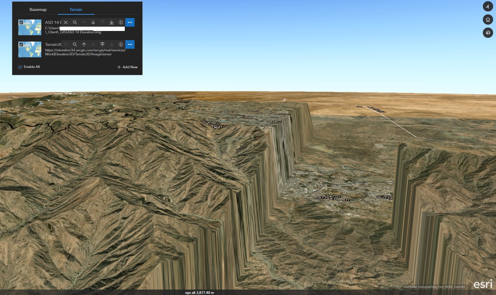
Hi, I've been trying to add some more detailed 10 m resolution DEM (as a IMG file stored locally on my machine). I'm adding that as a Terrain source, sitting above the Esri global elevation layer. However despite both data sources being set to visible, the Esri source does not appear when I got my own DEM switched on (creating a very steep cliff and flat earth!).
Any idea what I'm doing wrong?
Bruno