Hello ESRI-community  ,
,
I am working with creating a Geodatabase of buildings and have run into an issue I wanted to get straightened out.
I have a written a software to parse buildings from GML into ESRI geometries and then store them in a GDB/SDE, but I seem to be able to get the Shapes working properly for some of the more complex building bodies.
The more complex buildings get their GML-data split into multiple parts which I want to merge into one shape in ArcGIS Pro.
So I do this by first creating a Polygon for each part, then taking all those polygons and creating one Polygon out of them.
The Issue I am having however is that some of the polygons end up as interior holes and some as exteriors, see this sample:
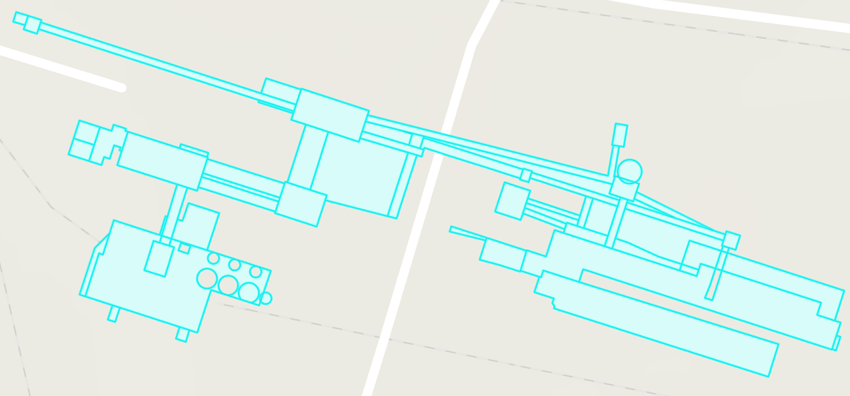
I have read some documentation saying that the order of the points in the polygon is important, as depending on if they are CW or CCW will determine if it will be an interior or exterior ring.
I have ensured that the points are in the correct orientation but am still having the same issue.
I have read some other documentation saying that a polygon within an exterior polygon will always end up as an interior polygon, and a polygon within that interior polygon will end up as an exterior polygon and so on.
Could anyone give me some direction on this? I have created a sample application for this which i could attach if what I am trying to accomplish should be working but I have ran into some issue
Thanks!
Best regards
Lars






