Hi guys, a mapping newbie/volunteer fire officer here. I'm attempting to create a fire run book using the "Fire Service Maps" add-on on ArcGIS PRO 2.2. Some really basic stuff is stumping me already.
I did procure parcel outlines and Streets shapefiles from the county, but I don't know when/where to use them. I'm going through the tasks and I'm at "Load data into SiteAddressPoint feature class". Here's what it's giving me the option of doing:
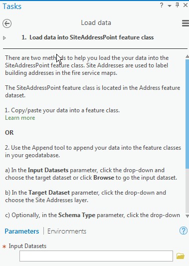
I suppose I could just forge forward and try to see if the streets shapefile is able to be pulled in here, but I thought it'd be better if I asked first. And when should I import the parcel outlines shapefile?
Sorry for the newb question. (And I'm sure I'll have more to come!)
Thanks!






