Hi there,
I am observing differences in how ArcGIS Pro calculates geometry/coordinates in DMS (degrees minutes seconds).
The process in ArcMap was very straight forward:
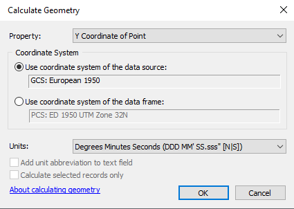
While in ArcGIS Pro, you have to also double check and set the environmental settings:
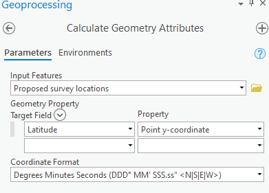
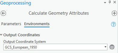
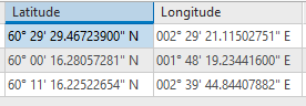
Now these are the results:
ArcGIS Pro
ArcMap
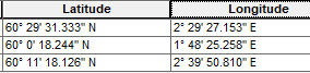
The seconds are always different. Sure, it is just a couple of seconds but still, why is there a difference in the results of the calculation?
The issue is that we are providing colleagues and customers with the coordinates who themselves plot them into their software and then we get quite some deviation.




