Hello community,
For a class project, I went out on campus and collected GPS coordinates for various trees. I also recorded their DBH values. On ArcGIS, I mapped the points over an aerial map of my campus. This is what I have as a result:
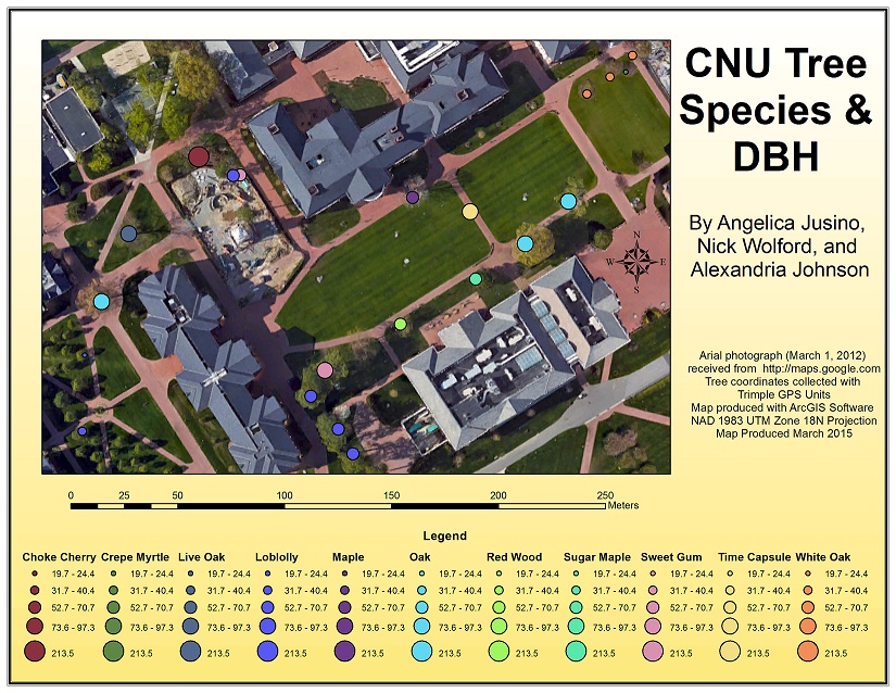
What I want is one section in my legend listing the tree species and their appropriate colors. In another section, I want just one of the lines of varying sizes of symbols. Is this possible?


