My first informal geospatial project
My name is Udit Bhatta, and I am a graduate student at Mississippi pursuing a PhD in geospatial technology. Before I enrolled in a master's degree in 2023, I was leading Nepal’s first green school initiative (Vajra Academy) as both the school principal and the director. Apart from what every school does, teach established curricula, we created our own special curriculum, Green Studies, as a completely experiential, project-based learning subject. We created opportunities for students to engage in organic farming, learn about sustainable technologies, pollution, and activities on natural resources conservation, sustainable use, repurposing, and developing energy-efficient solutions for the campus.
Among other duties, I co-developed community-oriented projects with students and teams to challenge students to develop solutions to real-world problems. One of the problems we were looking at was the loss of wetlands and reservoirs in the community with rapid and unplanned urbanization.
With the students from high school, we compared the changes in such wetlands over a thirty-year period with the google earth images, my first-ever, unknowingly taken GIS project. The students loved the project as much as I did, and we got a sense of how these wetlands changed over time and how that can be tracked. The result was shared in the local government offices and enhanced the collective understanding of how human constructions had encroached these vital aquifers.
It did two amazing things: first, it showed these young students how to research real-world community challenges; second, it expanded my horizons further on how spatial thinking can visually inform understanding and decision-making.
Turning point: Too late to learn?
I enjoyed the work I did and had a wonderful team, but at some point, I felt deeply motivated to expand my work to a new level and continue my path in science. Earth sciences, geography, and technology were some areas I was strongly considering going into to complement the skills I had gained through experience in education, communities, and natural resources conservation.
Then, inspired by my mentor and my advisor, Dr. Narcisa Pricope (Professor and Associate Vice-President for Research and Economic Development at Mississippi State University), with whom I had the opportunity to work as a field research assistant mapping vegetation in the mountains several years ago, I decided to pursue a Master's in geospatial technology. When I started the master's program in 2023, initially, I had several doubts: Isn’t it too late to change fields? Too risky for a career pivot? Maybe it’s too difficult or too technical? But, already within a few months into the program, with incredible support from my advisor, the challenges started to look interesting, and my doubt about being too ‘technical’ gradually faded as I learned to turn messy data into exciting visualizations. The program became increasingly exciting as I realized how my previous work with youth, communities, and conservation would be enhanced by these skills.
I had begun from these very foundations on this journey. This started with understanding the global positioning system (GPS), the first ‘GIS’ use-case for the Cholera outbreak, and the ever-expanding use of this technology in unimaginable and incredible ways. I realized one important thing: once we get past the initial internal pushback that holds us back from learning new skills, taking pivots, and up-scaling ourselves, it is a field of renewed curiosity, joy, and a heightened sense of self-belief.
As a budding geospatial professional who started out later than many would, I am at my best, and I know I will continue to be. The best part? What I felt was a ‘change’ was not in fact a change; it was an extension, a continuation, a means of accomplishing things differently. I absolutely love it!
How do I compete with others already in the GIS field?
Some of my own deeper critical voice raised concerns occasionally: how can you keep up with rapid technological developments, or with people who have already been in it for a while? Then it dawned on me, as I continued my master's in geospatial, that we are competing with ourselves more than with others to learn, to stretch, to get out of that comfort zone.
Now, here’s my take on how to compete: there’s no dearth of problems to solve in this world, so there’s no fear of competing with anybody else. I would be more concerned with competing with myself and training myself to find solutions using the skill sets and tools we have, and collaborating to solve big problems facing us. That’s what it means to be a meaningful human and contribute to a better world. The best thing I can do today is to learn new skills and apply them to create something, and the ways to compete will emerge as a result. Anyway, we’ll find ways to win! (over our barriers set for ourselves).
Best time to get into GIS?
The best time to get into GIS was yesterday. But the next best is to get into it today! Why?
First, the availability of web tools and resources, the community, and a robust ecosystem for people learning GIS at any level has lowered the barriers to entry in this journey. We have plenty of learning resources, including ESRI’s massive open online course (MOOC), freely available training, and learning communities, such as the Young Professionals’ Network (YPN). Even beyond these, open-source platforms like YouTube make resources more easily accessible.
Second, GIS is a tool that can be used in ways we can’t imagine. For example, from global-scale vegetation analysis to personal home-level interior planning and inventory, from serious remote sensing applications to mapping our gas pipelines into our houses, its use cases will only keep stretching to our creative limits.
Third, and my personal favorite about GIS is the unique, powerful confluence of data, mathematics, technology, and arts (of course, it's all of STEAM- Science, Technology, Education, Arts, and Management). The result is a beautiful prospect of enhancing science storytelling to address problems we see in our communities. Our storytelling just gets better and enhanced with the adoption of GIS. The potential of scientific, data-driven, artistically refined storytelling has implications for better decision-making at any level.
My project with GIS
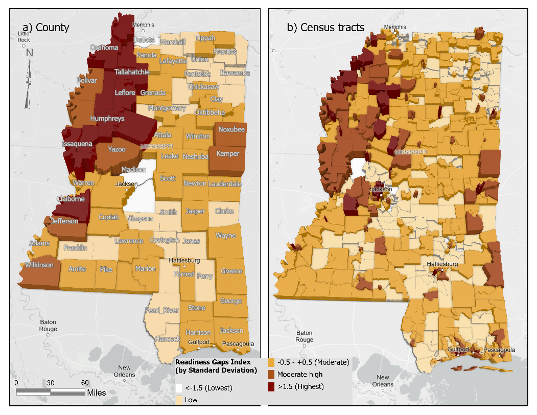
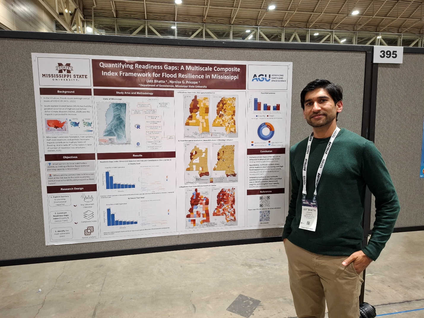
I mapped the vulnerable counties in Mississippi based on flooding impacts, assessed their preparedness, and created a tool to identify areas for prioritized mitigation and resilience efforts. I have seen the counties in Mississippi with extensive technical and financial capacities, while others struggle. I am working with the county here in Mississippi and my University to develop a functional model for how students can contribute to taking steps towards solving local problems and be equipped with valuable real-world skills when they do. So, for me, a Geographical Information System is now something to be “Grounded in Service.”
Overall, I am happy to be in the geospatial community and to learn from and grow every day!
What I have learned today wouldn’t be possible without the MOOC’s and resources from ESRI , I am grateful!
Feel free to connect with me on LinkedIn or email me at ub57@msstate.edu