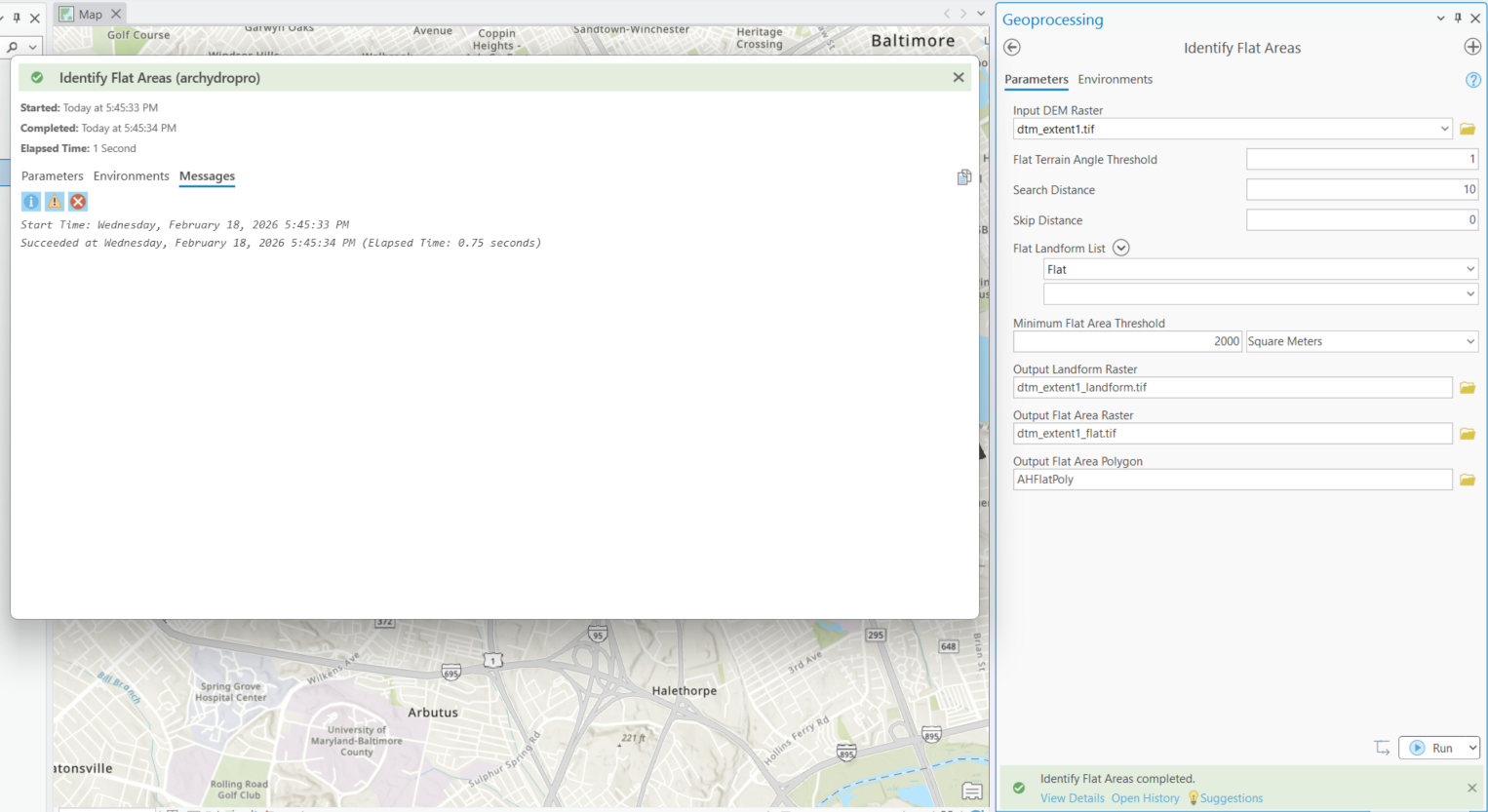
Ich versuche, ein Hochwasser-Tiefenraster zu erstellen, damit ich das Flood Impact Analysis Solution (FIAS)-Werkzeugsatz in meinem Wasserbezirk ausführen kann. Ich folge dem Leitfaden zum Erstellen von Hochwasser-Tiefenrastern für die Flood Impact Analysis <\/A>, stoße jedoch beim Abschnitt zur Behandlung von flachen Bereichen auf Probleme. Wenn ich das Arc Hydro Identify Flat Areas-Werkzeug auf dem bereitgestellten Beispiel-DEM ausführe, wird das Werkzeug erfolgreich abgeschlossen, aber es werden keine Raster oder Layer erzeugt. Ich verwende ArcGIS Pro 3.6.1.<\/P><\/span><\/P> <\/P>Identify Flat Areas=====================Werkzeugpfad<\/P>Eingabe DEM-Raster dtm_extent1.tifFlacher Gelände-Winkel-Schwellenwert 1Suchabstand 10Überspring-Abstand 0Flache Landform-Liste FlatMinimaler Schwellenwert für flache Fläche 2000 QuadratmeterAusgabe Landform-Raster C:\LOCATION\ArcHydro\FIAS\Layers\dtm_extent1_landform.tifAusgabe Flache Fläche Raster C:\LOCATION\ArcHydro\FIAS\Layers\dtm_extent1_flat.tifAusgabe Flache Fläche Polygon C:\LOCATION\ArcHydro\FIAS\FIAS.gdb\Layers\AHFlatPoly=====================Meldungen<\/P>Startzeit: Mittwoch, 18. Februar 2026, 17:45:33 UhrErfolgreich abgeschlossen am Mittwoch, 18. Februar 2026, 17:45:34 Uhr (Verstrichene Zeit: 0,75 Sekunden)<\/P>
<\/span><\/P> <\/P>Identify Flat Areas=====================Werkzeugpfad<\/P>Eingabe DEM-Raster dtm_extent1.tifFlacher Gelände-Winkel-Schwellenwert 1Suchabstand 10Überspring-Abstand 0Flache Landform-Liste FlatMinimaler Schwellenwert für flache Fläche 2000 QuadratmeterAusgabe Landform-Raster C:\LOCATION\ArcHydro\FIAS\Layers\dtm_extent1_landform.tifAusgabe Flache Fläche Raster C:\LOCATION\ArcHydro\FIAS\Layers\dtm_extent1_flat.tifAusgabe Flache Fläche Polygon C:\LOCATION\ArcHydro\FIAS\FIAS.gdb\Layers\AHFlatPoly=====================Meldungen<\/P>Startzeit: Mittwoch, 18. Februar 2026, 17:45:33 UhrErfolgreich abgeschlossen am Mittwoch, 18. Februar 2026, 17:45:34 Uhr (Verstrichene Zeit: 0,75 Sekunden)<\/P>
We have found that trying to drop a .tif into the GDB does not work! Create a separate folder and change the default path for output to it.
Yes it is, thank you. Reinstalling did not seem to fix the issue. I did notice that the installation file states ArcHydroToolsforArcGISPro3.5.msi, so I am wondering if this is a versioning issue, since I am running ArcGIS Pro V3.6.1.
Arc Hydro Tools Downloads for ArcGIS Pro & ArcMap
Downloading and Installing Arc Hydro Tools | 2023
hoping this is the download link access point
Hi Dan,
Thanks for your response. When I run the tool, no files are generated. I've checked the output locations and nothing appears, and nothing is added to the ToC.
Unfortunately, the AH download link that Dean shared in his response to the other post is broken. I will try to re-download my version of AH to see if that fixes anything.
Are results automatically added to display for geoprocessing tools?
Have you confirmed that the 2 *.tif files don't exist in the output folders?
If they do exist and they are listed in the map's table of contents, do a right-click on one of the layers and zoom-to-layer (maybe a different ill-defined coordinate system)
Also... a related thread Arc Hydro Characterize DEM - Flat Area Raster step... - Esri Community
Angemeldete Mitglieder können Beiträge verfassen, Updates folgen und mehr. Neu hier? Registriere ein kostenloses Konto.
Find useful guides, FAQs, and documents to help you navigate and make the most of Esri Community.