I have a polygon dataset of buildings that I have configured to display labels showing the building name. This works fine when I have a single label class configured in Map Viewer, but if I add a second label class and configure the two label classes to have discrete (non-overlapping) 'visible ranges', at certain zoom levels they both display. The setup I have is as follows:
First label class
- Visible range: 1:5000 - 1:2000
- Font size: 13
- Colour: black text with white halo
- Position: Offset Y:10 (so they draw above the centre point of the polygon)
Second label class
- Visible range: 1:1999 - 1:0
- Font size: 10
- Colour: blue text with white halo
- Position: Offset Y:-10 (so they draw below the centre point of the polygon)
Here's how they display at three different zoom levels:
1:4,514
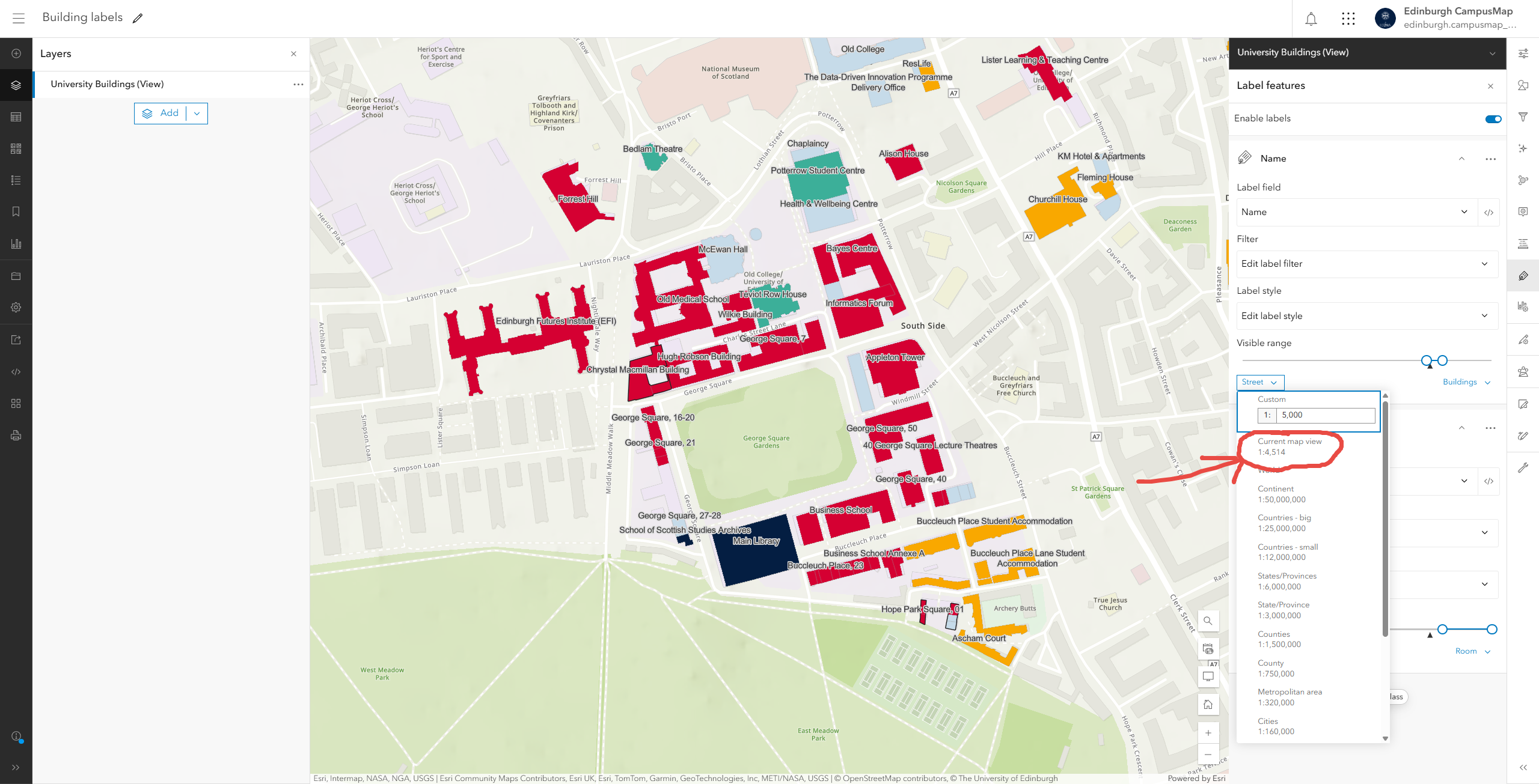
This is correct, only the first label class is displayed.
1:2,257
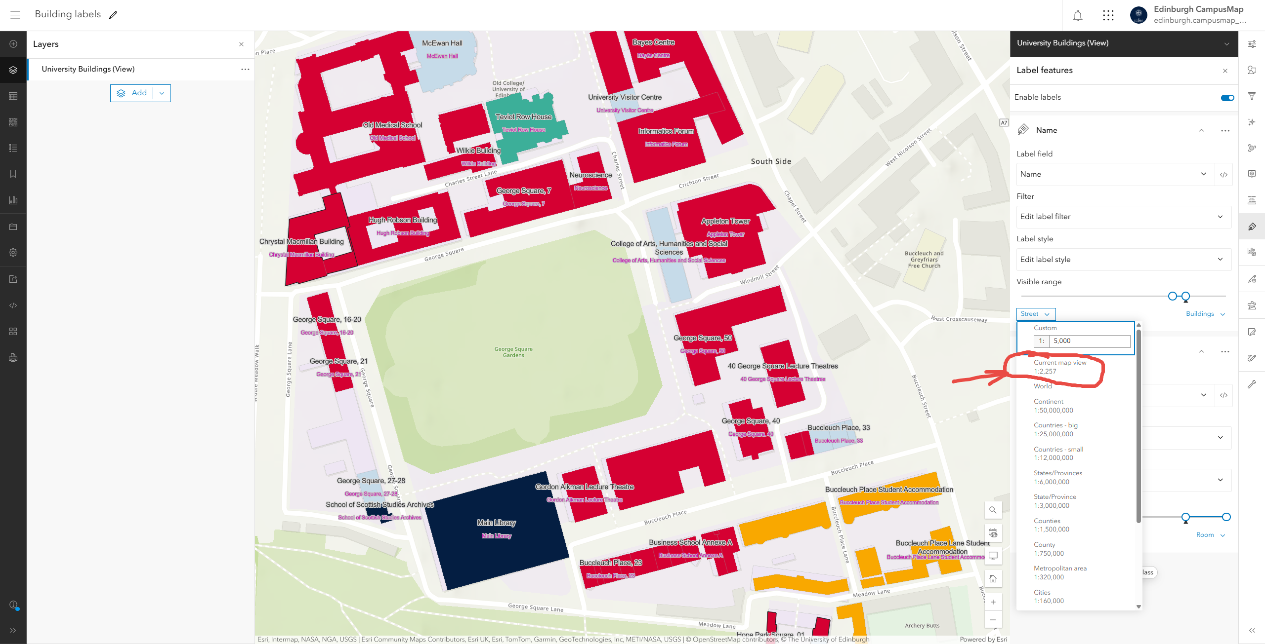
This is incorrect as both the first and second label classes are displayed despite the current map view scale being outwith the specified visible range of the second label class.
1:1,128
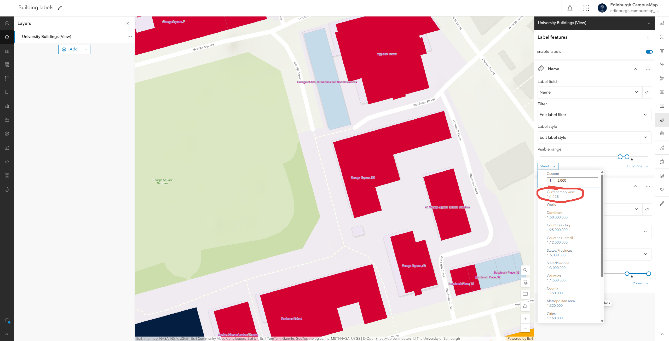
This is correct as only the the second label class is displayed.
What am I missing/doing wrong here? Given that the two scale ranges for the two label classes do not overlap I don't see how there could be any situation where both sets of labels display at the same time.
The map that shows this is available to everyone here: https://maps.arcgis.com/apps/mapviewer/index.html?webmap=cf2af081f4c24a7a9db3a869fdf49244
This feels like a bug as I can't understand why it's behaving like this but any help would be greatly appreciated.





