Hello Everyone,
I try Bathymetry extension in ArcGIS Pro 3.4, then have some questions. Please give me your advices.
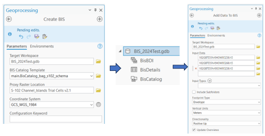
1. Create BIS tool -> have 3 files, including Mosaic Dataset BisBDI -> and Add Data To BIS
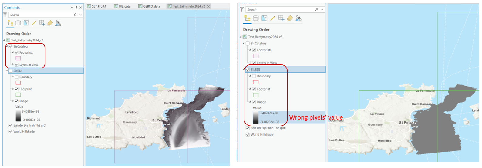
2. I view results in ArcGIS Pro, including Bis Catalog and BisBDI
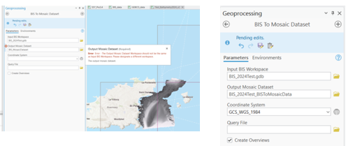
3. I run BIS To Mosaic Dataset, this Output Mosaic Dataset need to create in anther Geodatabase, canot create in the BIS geodatabase.
4. Then view results, and I see there has a different pixels' value between BISCatalog and BisMosaicDataset
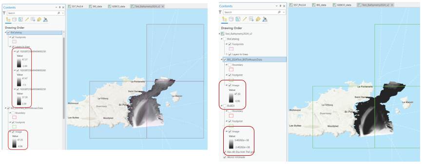
My questions: we can not use BisBDI as a final Mosaic Dataset, then use it to publish into Portal with ArcGIS Image server extension. Instead, we need to Create new Mosaic Dataset outside BIS geodatabase, then run BIS to Mosaic Dataset tool. And about the pixels value between 2 resutls BisCatalog and BisMosaicDataset?
Thank you.


