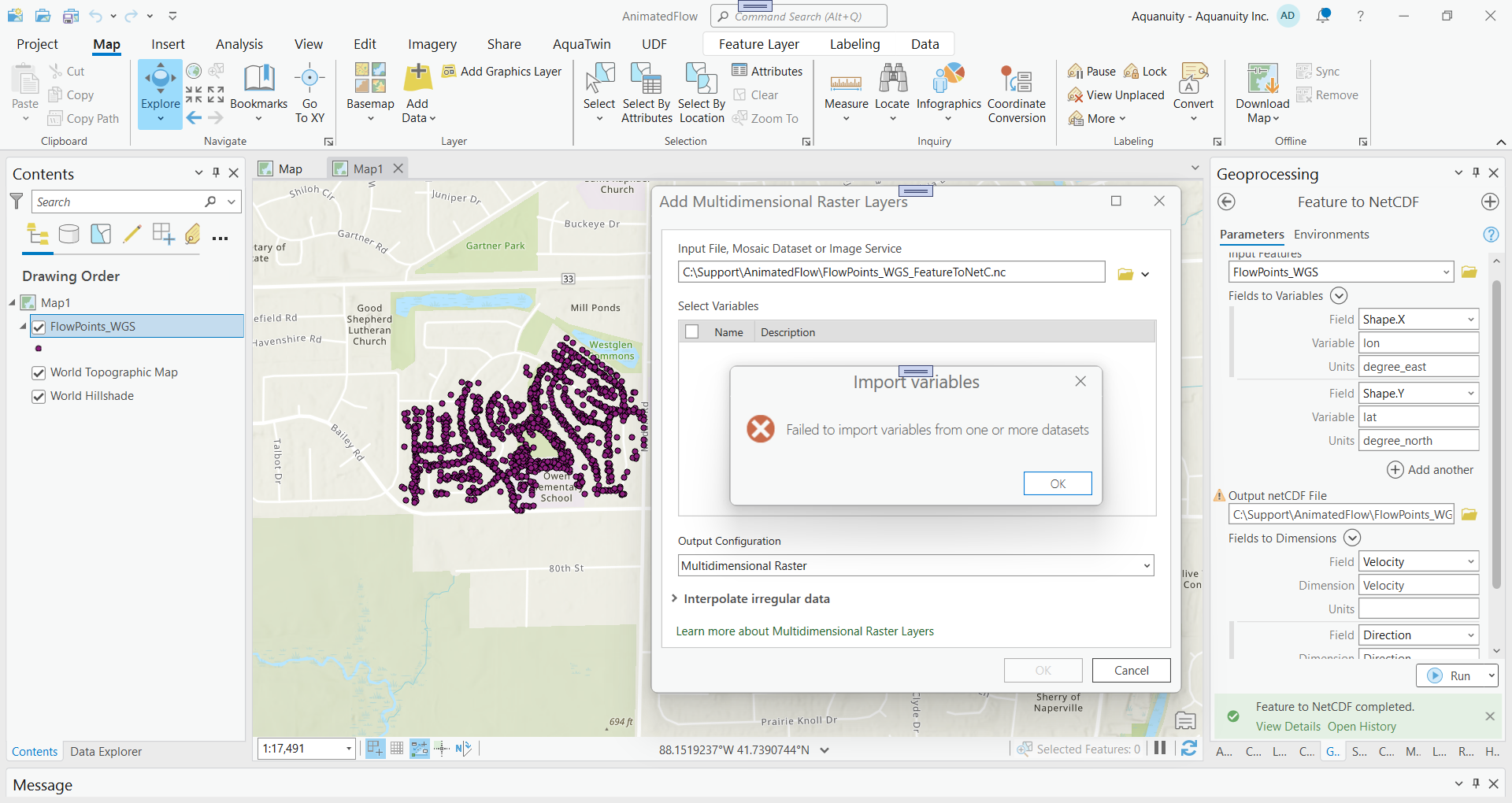
I have some difficulties to create a NetCDF file from point features using Feature to NetCDF GP tool. The following picture shows how I setup. The tool ran successfully but I can not load it into the map using Add Multidimensional Raster Layers. What did I do wrong? Any hints will be greatly appreciated. Attached is the point feature data from a geodatabase.
@HongXu , Hi, thank you veru much. I will have a try.
The Multidimensional Raster Layers tool is designed to work with raster data, not point data. I see you have point feature class, please try with animate symbol directly on your feature data. see the doc at Animate marker symbol layers—ArcGIS Pro | Documentation
Thanks a lot!
@AquanuityDevelopment Please try the following steps:
1. Convert your FlowPoints_WGS to TIN, then to Raster, and finally to Point FC.
2. Convert your Point FC to the Geographic Coordinate System.
3. Use the following parameters for the tool: Feature to NetCDF
arcpy.md.FeatureToNetCDF(out_shp,[['Shape.X','lon'], ['Shape.Y','lat'], ['Shape.Z','z'], ['Depth','Depth']], out_nc, [['lon','lon'], ['lat','lat'], ['z','z']])
Hope it works.
Angemeldete Mitglieder können Beiträge verfassen, Updates folgen und mehr. Neu hier? Registriere ein kostenloses Konto.
Find useful guides, FAQs, and documents to help you navigate and make the most of Esri Community.