Hi Team,
I am working on Canada FSA Digital Boundary Files which are available on gov website (https://www12.statcan.gc.ca/census-recensement/2021/geo/sip-pis/boundary-limites/index2021-eng.cfm?year=21).
I have download this shape files and it is in EPSG:3347 NAD83 / Statistics Canada Lambert coordinate system, now my requirement is to transform this into EPSG:4326 but after changing the projection polygons shape is changed and on arcgis online it is displaying very bad. Can you please help me , how to change the cordinate system so its view should be correct
Did you use the
Project (Data Management)—ArcGIS Pro | Documentation
or
Define Projection (Data Management)—ArcGIS Pro | Documentation
The first is the correct tool to use, the second is only to be used if the data does not have a defined coordinate system to begin with
Hi,
I tried first option Project(Data Management) to change the projection system.
In Existing Data coordinate system is NAD83/Statistics Canada Lambert Coordinate reference system and i want to change it into EPSG 4326, after changing the coordinates its shape change.
This is the actual data of canada FSA, (NAD83/Statistics Canada Lambert Coordinate reference system)
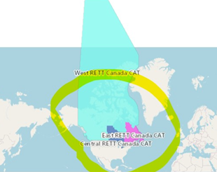
After applying EPSG:4326 it becomes this shape.
Don't use the cartographic version, and add extra vertices to preserve shape during the projection
The above is a plain wgs84 version of the lambert
Angemeldete Mitglieder können Beiträge verfassen, Updates folgen und mehr. Neu hier? Registriere ein kostenloses Konto.
Find useful guides, FAQs, and documents to help you navigate and make the most of Esri Community.