I am creating a network dataset and I see some strange maneuvers on the data:
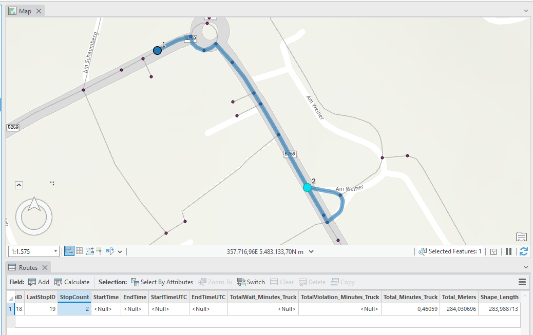
SO coming from the NorthWest, I am passing the stop and make a turnaround.
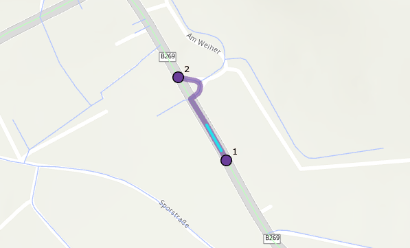
Coming from the southeast I am making this detour.
Yet if the stop is not placed on a junction the route just looks fine!
I have tried several settings in the curb approaches and yet I was not a able to get the shortest/fastest route.
Does anyone have an idea where to look at? I tried all travel modes and all measurements, recreated junctions and so on. Still I have no clue where this might come from!


