Hi,
I am trying to mask a FEMA Flood Area Hazard feature layer to the Orange County, CA boundary layer in the New Map Viewer. I am following this tutorial: https://www.esri.com/arcgis-blog/products/arcgis-online/mapping/create-a-clipping-mask-in-arcgis-onlines-map-viewer/ by John Nelson.
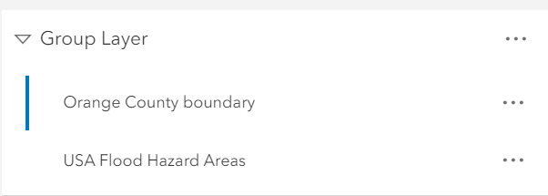
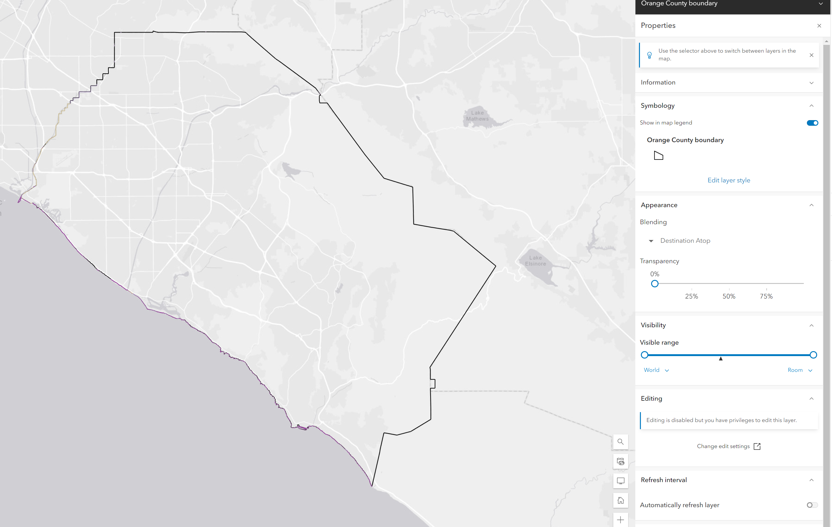
However, when I group and then blend using Destination Atop, the flood layers only display on the boundary outlines. Anyone know how I can troubleshoot this bug so that the flood layers display within the OC boundary?
Screenshots below:
Hi @ChrisGiamarino,
It looks like the Boundary is just an outline in your map. You'll need to style the Orange County boundary layer and apply a fill, that should give you the results you are looking for.
Angemeldete Mitglieder können Beiträge verfassen, Updates folgen und mehr. Neu hier? Registriere ein kostenloses Konto.
Find useful guides, FAQs, and documents to help you navigate and make the most of Esri Community.