Hello,
I am currently using ArcGIS Pro 3.0.2. My dataset consists of residence census tract, workplace census tract, and the number of people who commute from the residence census tract to the workplace census tract. The following is an example of my dataset:
residence_id workplace_id commute
0101 0203 50
0503 0602 20
I have a map of census tracts. I am looking for a way for ArcGIS Pro to draw arrows from the residence census tract to the workplace census tract, in this case, from tract 0101 to tract 0203, and from tract 0503 to tract 0602.
The following is an illustration of what I would like to achieve:
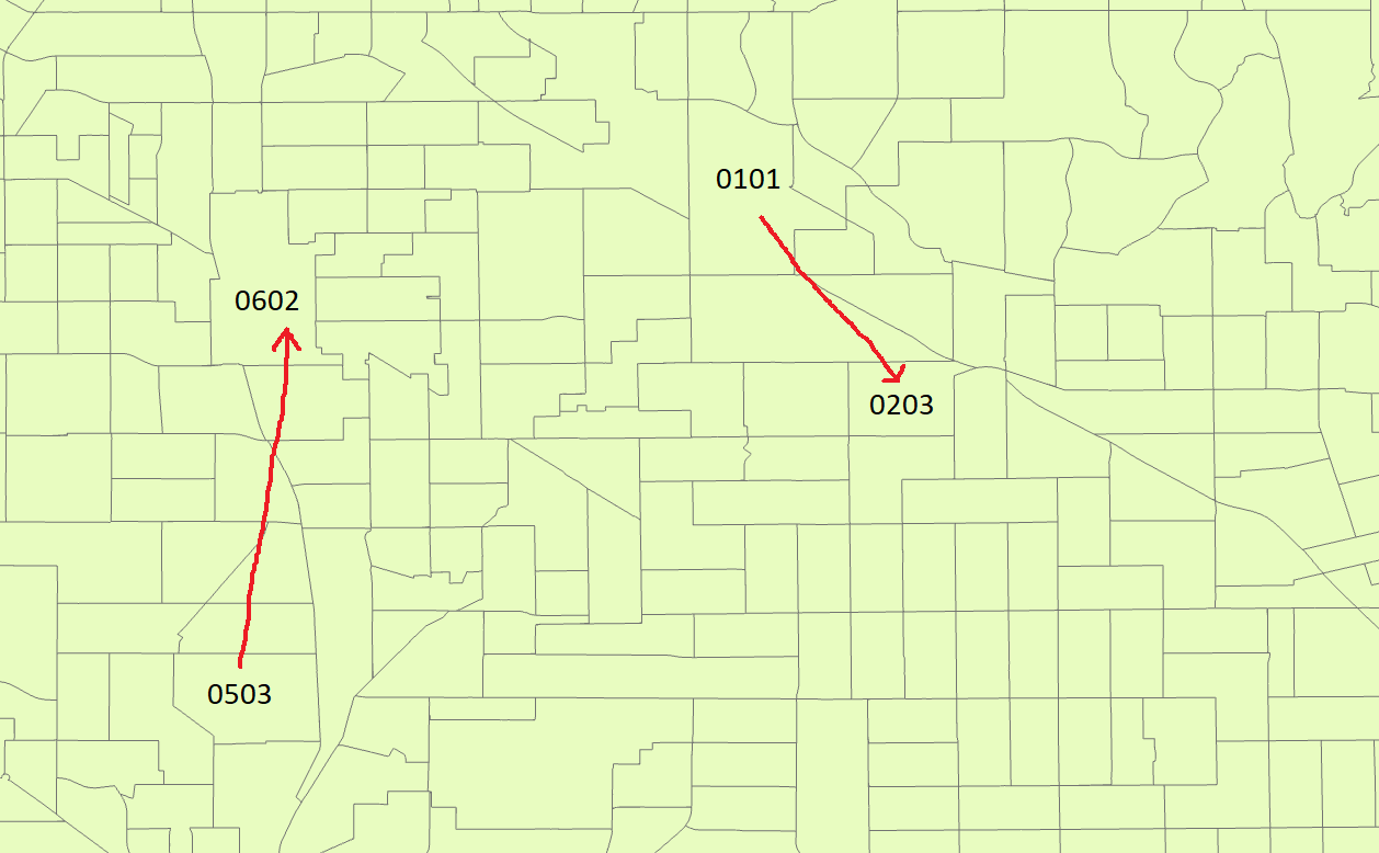
If possible, I was wondering how to make the size of the arrow proportional to the size of the commute flow. For example, since there are more people commuting from 0101 to 0203 than from 0503 to 0602, the arrow from 0101 to 0203 should be thicker than the arrow from 0503 to 0602.
Any ideas will be greatly appreciated. Thank you!

