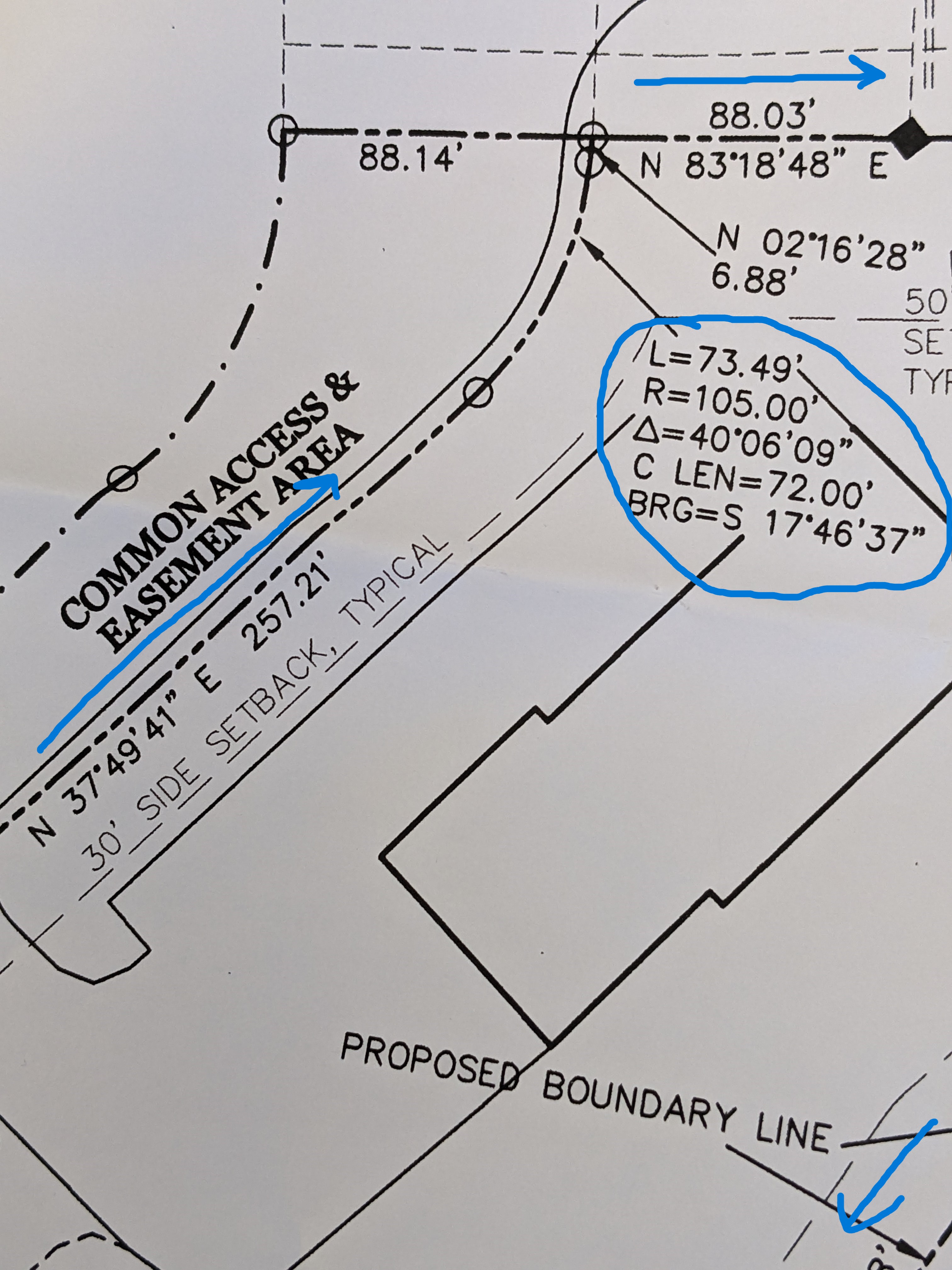
I'm confused about how to enter in a traverse in ArcGIS Pro. I'm used to keying in bearings and distances going around a parcel (but not curves). My experience is that plans mailing go around it in one direction (clockwise or counterclockwise). In the example below, it is indicated as mainly clockwise but there is a curve thrown in that goes the other way.
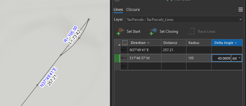
In the example below, you see NE bearings but then there is a SW for the curve. When I key it in, the curve goes the wrong way (see below).
Here it is as entered. The curve goes the wrong direction.
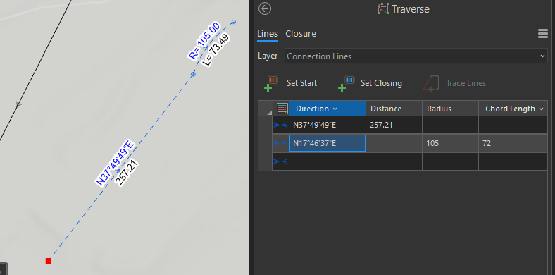
If I tell it to go NE, the curve doesn't match the plan.
Can someone correct my understanding of how to do this? Or do you see what is going wrong?

