Hello,
I've posted something like this a few years ago and got no responses, so I guess I'll just keep posting until someone from ESRI replies...
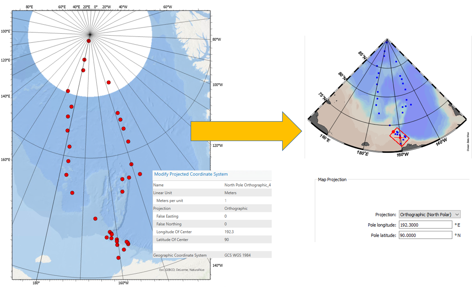
Can we make maps for the Arctic/North pole region that are shaped conically as can be done in software such as Matlab (I don't use, but have seen output) or Ocean Data View? I've tried using the same projection (orthographic) and settings that produces this effect in Ocean Data View, but it's still just a rectangle...🤔
It's frustrating not to produce maps in ArcGIS that are similar in nature to oceanography colleagues...🙁
Thanks...