My CEO is my only field collector so my workflow is a bit backwards compared to most.
Boss asked me to update colors on symbology for irrigation heads. He needed this to happen ASAP, while he was in the field and collecting. He had already collected a few points so my options were limited to telling him to stop collecting, download the map, change the symbols and reupload the group or change the symbology in ArcGIS Online. I ran into issues with online and chose to go the former route and have it good for now. I'll need to come up with a better workflow for this.
1: I figured out how to make changes in Map Viewer(new) but the fill option is still greyed out. Is there another method? I also tried looking in field maps and in the content settings for the group layer.
2: See pic 1 and pic 2. Pic 1 shows me successfully changing a symbol's fill that I uploaded from Pro. 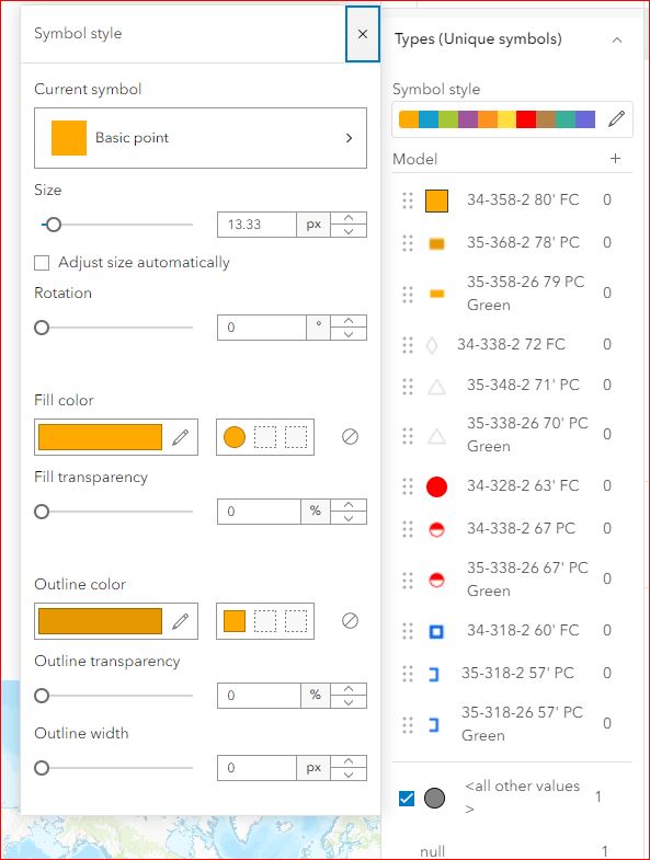
The second picture is this option greyed out.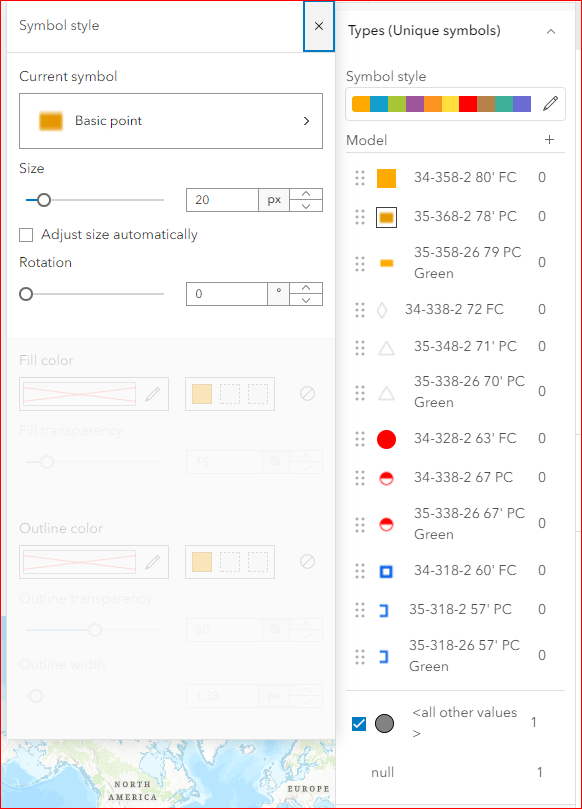
I've noticed that I can change the fill for symbols chosen in the "arcgis 2d" symbology galley (not from esri AM/FM Sewer and Water fonts which I need). If this is the case, it harshly limits my options and makes emulating someone else's (cad architect) symbology impossible.
I did find a post with a similar issue from 2017 but the "map viewer classic, symbology as image, edit transparency and color in another program" method isn't a solution as doing this process for 10 point features will take longer than re-uploading the layer.




