I’m trying to produce a map series that is defined by a set of area boundaries and includes land parcels, address points and street names like so:
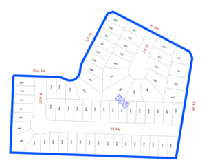
The problem is that it’s important to have the land base clipped to the exact boundary, while at the same time it’s important to retain nearby street names that are outside the polygon. However the street names still need to be clipped so that only bordering ones are shown and not those that are further away.
In Arcpro, it is possible to clip the map series to the index feature but I can’t find any way to include a ‘secondary clip’ on the street names.
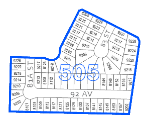
In a map series is there some way to allow those ‘outside’ street names to pass through? Could it include a query that clips the parcels with one polygon and the street segments with a buffer? Is there some way to clip them separately and put the results together?
All text are labels generated from map features if that makes any difference.
Thank you



