Hi,
I am trying to create an oriented imagery catalog from a CSV file with the RGF1993 CC49 projection system.
Creating the points works fine, but there is a problem with creating coverage features.
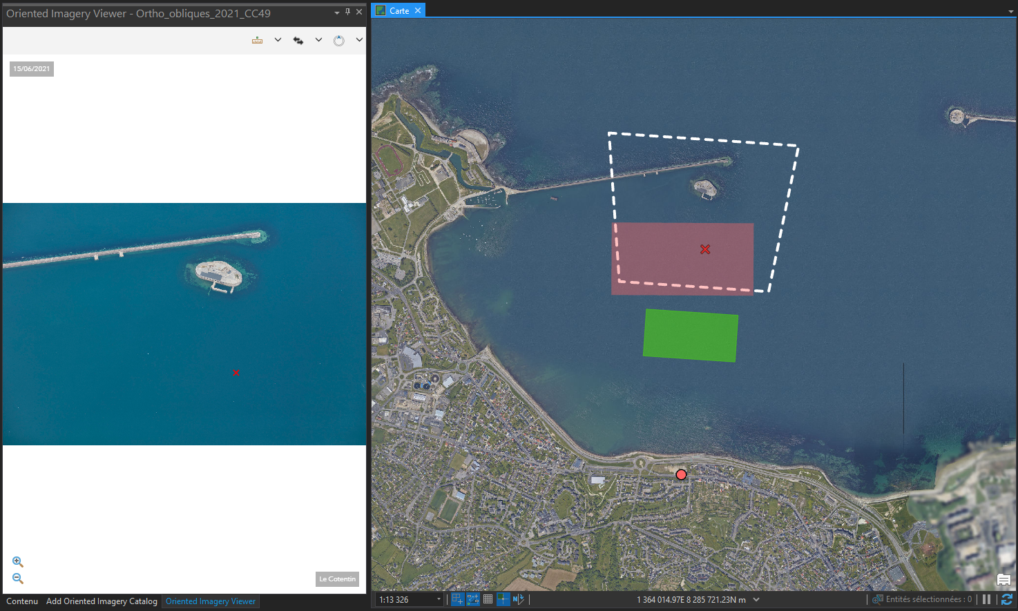
On the screenshot, we can see:
- The green polygon is the one created by the “Create coverage features” tool
- The red polygon appears when clicking on the map to open the oblique photography with the addin “Oriented Imagery”
- The polygon in white dotted lines represents the real polygon of the oblique photography.
I think the problem with the projection system, but I'm not sure.
My ArcGIS Pro version is 2.8.3.
I join my CSV file.
Thank you in advance for your help