I am using ArcGIS 10.8 Basic (occasionally Pro but mainly ArcMap).
I am afraid I am not even sure where to start looking but I would appreciate guidance on graph algorithms on a GIS scale. So basically my task is as follows:
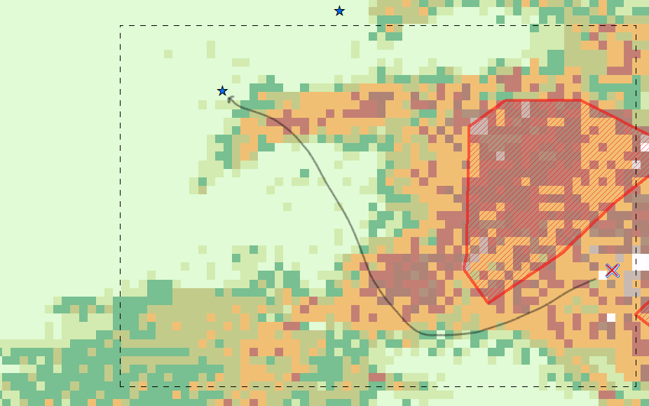
1. Within the bounds of the black box I need to find a path from point A to point B.
2. The shaded red polygons are no-go areas so they cannot be traversed.
3. The "optimum" path shall be one of two types:
a. The shortest geodesic distance between the points
b. The path with the lowest terrain traversed w.r.t to the grid raster. In other words, if we were to make a profile of the raster along the path then the path with the lowest max value. Ex: Path A traverses terrain that is at max 120, Path B traverses terrain that is at max 239, Path C traverses terrain that is at max 155, the optimum path in this case would be path A since it traverses the lowest grand max terrain value along its path.
Where would I start looking on how to solve this challenge with ArcGIS? I am quite proficient with ArcObjects and .NET. I'm just afraid I don't even know where to start.