Can I get some advice on what im seeing here?
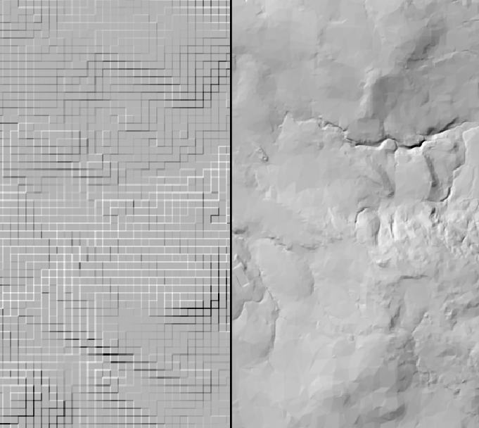
Below is a continuous raster with hillshade applied.
On the right is a 5m terrain dataset
On the left was a 50m terrain dataset that's resampled to 5m (with nearest neighbour interpolation) and was mosaiced with the one on the right to make a single tif raster.
Hillshade has been applied using an ArcGIS Pro rasterfunction.
There are some strange effects going on around the edges of pixels in the left hand data.
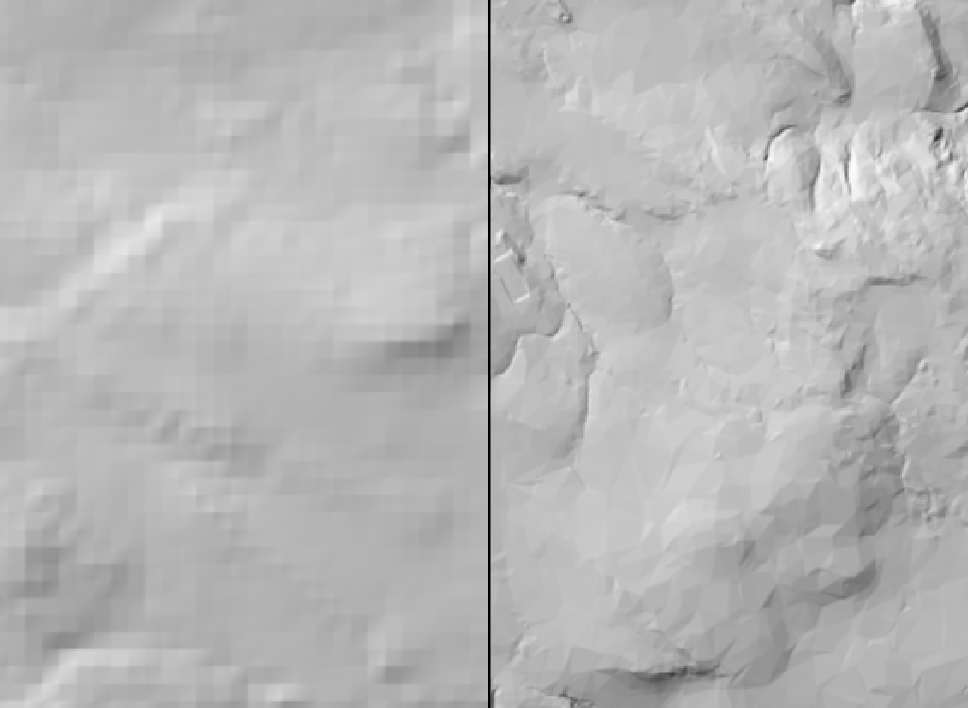
For clarity, if I change the resampling interpolation to bilinear, it smooths the pixels within each 50m group (100 pixel squares), and the strange effect goes away, but the 50m group of pixels is visible in the hillshade (indicating that the effectiveness of bilinear interpolation isn't quite perfect at smoothing).
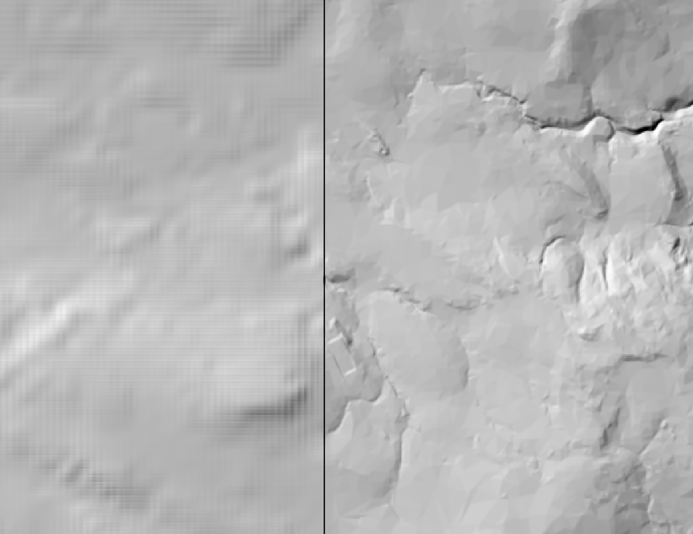
If i change the resampling technique to cubic interpolation, the smoothing appears to be more continuous, but you see some strange gridding artefacts in the hillshade again, different to the nearest neighbour example.
Question to the raster pros out there, any thoughts?
PS: i've dropped these datasets into QGIS and Global mapper too, and the same hillshade effects are there too.


