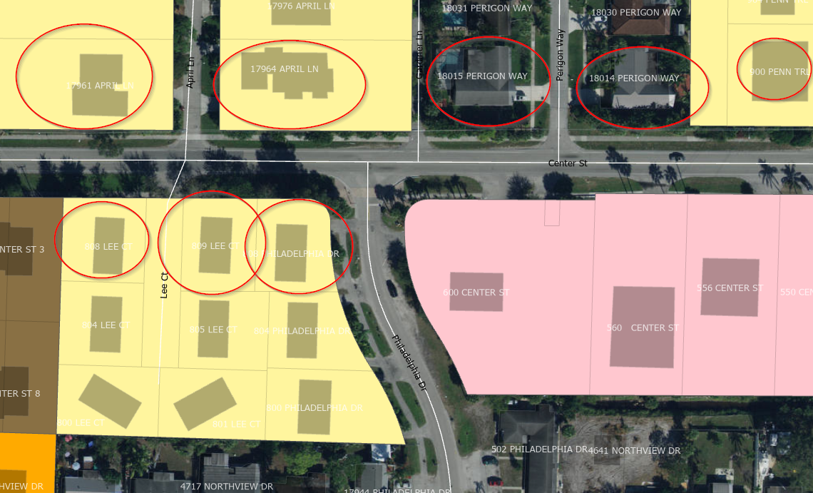
Is there a way to identify the "front" of a parcel based on the address and then offset that by a certain distance? For example, the properties in the image in pink all have addresses for the main road (Center Street) but the properties circled in red have their addresses to the side street. I want to be able to use a tool that will provide a polygon that will identify the area of the setback based on the address. Any ideas?