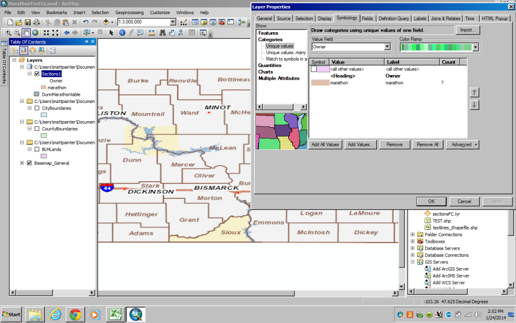
The new ownership shows up but doesnt display on the map?is there a setting im unaware of?
Thanks for helping me out so much i finally got it how i needed it, when i copied the section layer and unchecked null values from the symbol tab everything showed up?I learned a ton doing all of this. I really appreciate you walking me through most of this.
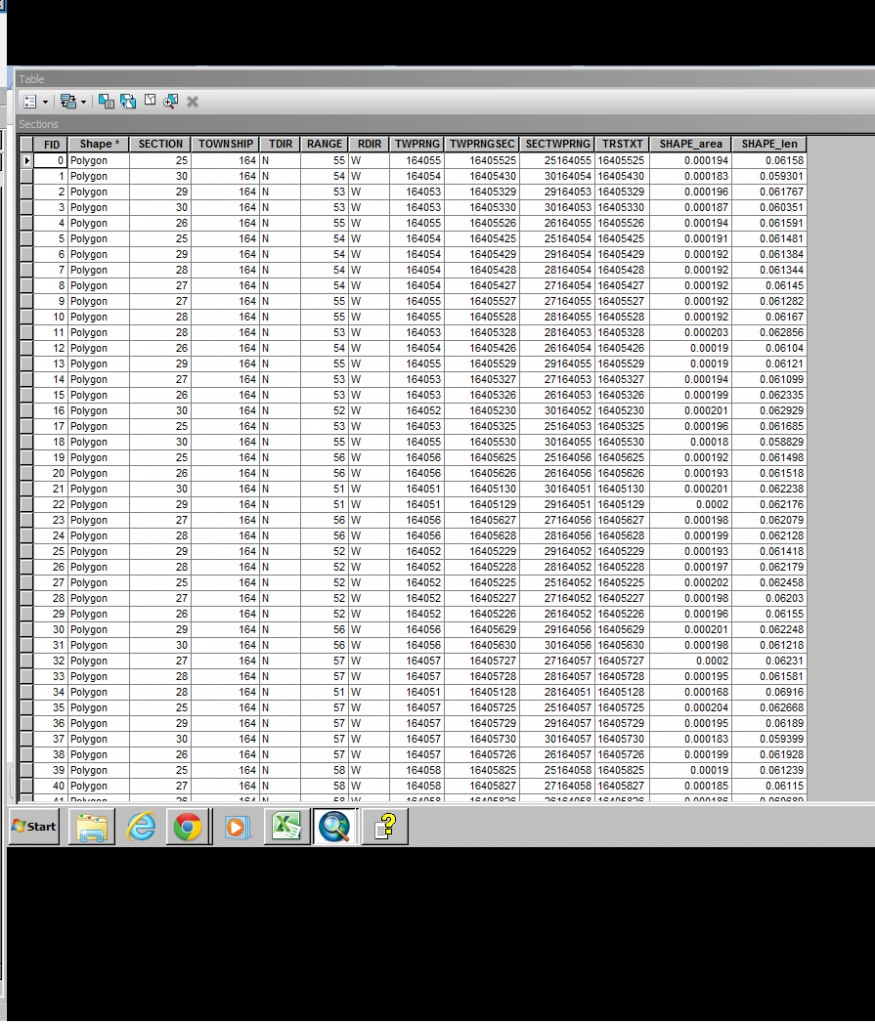
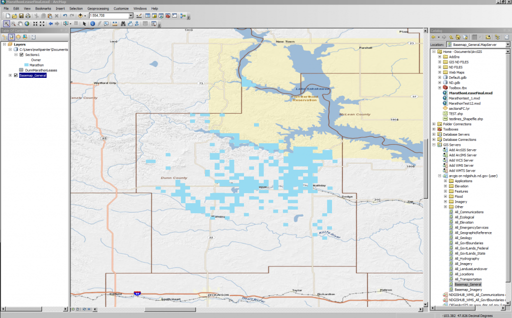
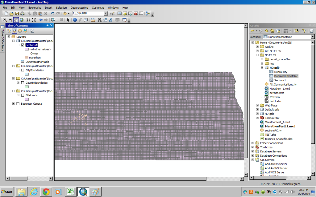
Alright i do understand i would have to edit the original table to make changes like that and force a restart but thats not what im talking about. these photos will shed some light on my problem First photo This photo shows the entire sections that has been joined with my data now how to i get my data to display over my other layers disregarding null values so it doesnt cover everything?
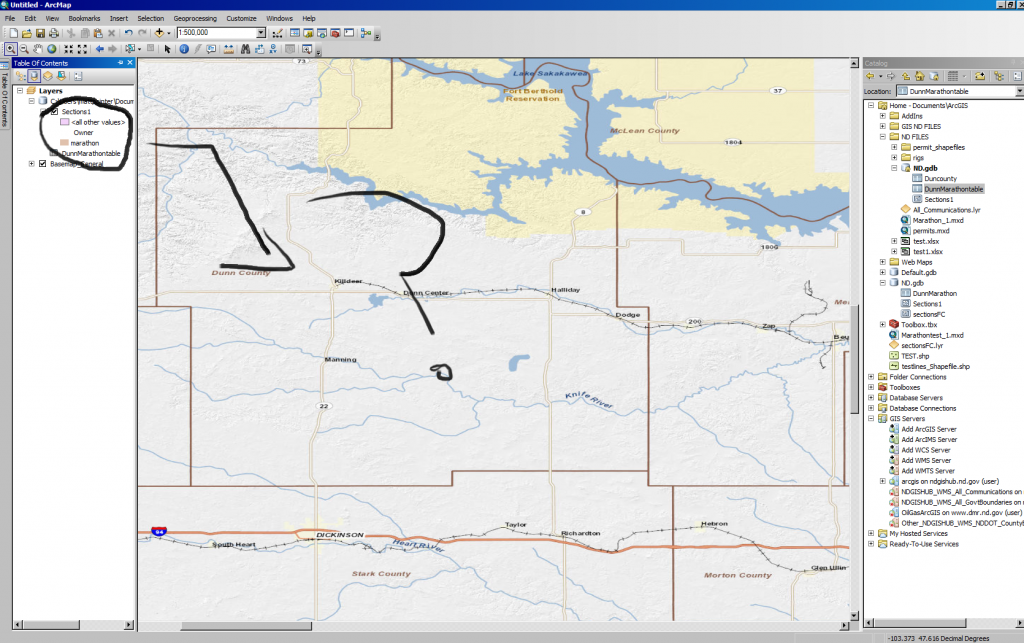
alright i totally understand what your talking about with editing the symbol and i can do it with any other file i load, but i cant edit anything on the joined file? its like invisible? while its loading when i make a change i can see that my land is displayed but its covered by the base map and wont display further? It acts as transparent but isnt.
alright i did what you said and imported a new table that has no formula only the values. Doing so TWPRNGSEC Owner columns are listed as text data fields and cannot be alter nor show up in the drop menu when trying to join? It gives me an error when trying to change them to double.
Alrightso i uploaded the table how you meantioned into a new file gdb to work from i included a column for ownership and a column thats the same as in my sections table and the formula looks like it matches up... cool beanswhen i imported the sections to my gdb as a feature class it seems like it screwed up some settings as you can see it fully shades my map? but skimming through properties its identical to the original??? whats the cause of this?alright now to join it finally... am i missing the simplicity of this project and making it harder than it is...here i join it although it doesnt list the corresponding column on my table??? why is this?
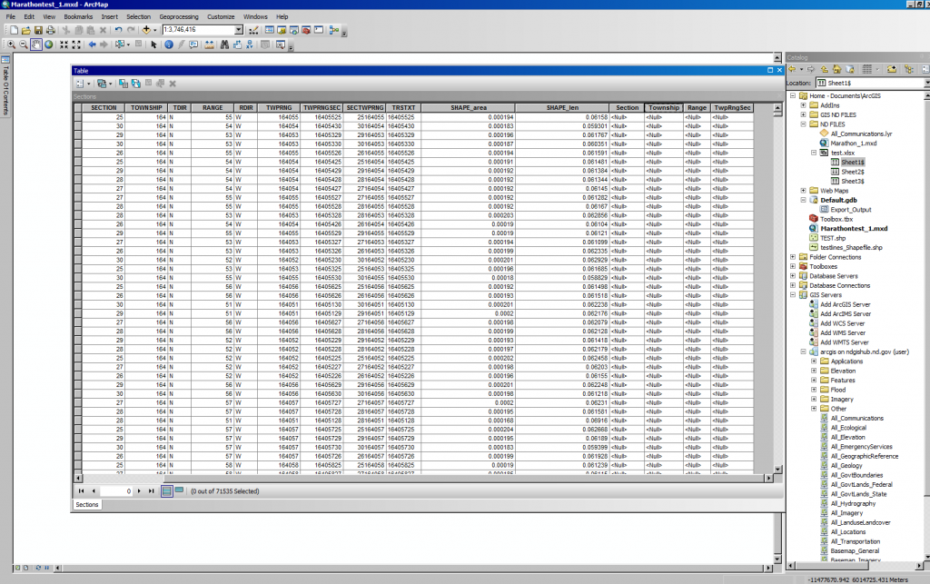
alright i believe i did everything you said but when i joined it my table shows up on the end as shown in the photo but doesnt so anything?
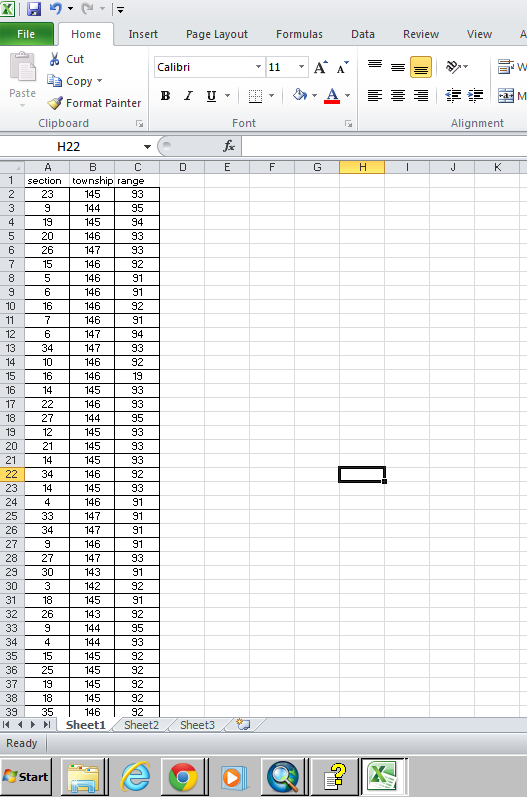
I assume all Townships are North in your jurisdiction and all Ranges are West for your ownership data and in your jurisdiction. So you would only need to deal with the numbers. This is shown in the TwpRngSec field of your Sections table with a value like 16405525. Check if that column is a text field or a number field.Add a column header in the next empty column of your ownership table named TwpRngSec (in cell D1). To make a text value in your owner table that would match the value in that same column in the Section table you would add a formula to cell D2 that reads:=CONCATENATE(IF(B2<100,"0",""),IF(B2<10,"0",""),B2,IF(C2<100,"0",""),IF(C2<10,"0",""),C2,IF(A2<10,"0",""),A2)If the value that appears is 14509323 the formula worked. Copy that formula down to the bottom of the table (double click the cell corner).This formula should work for all Townships from 1 to 999, all Ranges from 1 to 999 and all Sections from 1 to 36 (and technically also up to 99).The Excel table can be joined on the column named TwpRngSec to the field named TwpRngSec in the Section table provided it is imported into ArcMap with field type that is compatible with the one used in the Section table. Or else join it to the TRSTXT field if it imports as text.Do not use the Excel table directly for the join. Import it to a File Geodatabase table or a dbase table. (I always use File Geodatabase Tables and Feature Classes and hate shapefiles). If the relationship is one to many (one section has many owners) you need to import both the owner table and the Section shapefile into the same File Geodatabase to use the Make Query Table too correctly.
alright how do i join to two tables together?explain it idiot proof for me 🙂
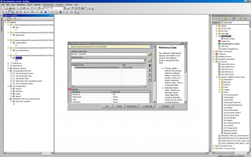
You only showed the Section table. Show the relevant Section Township and Range fields of the Owner data that could match that.I would not bother with an address locator at all. I would do a standard concatenation of the section fields to form a single string uniquely describing each section and create a Join/Make Query Table merge of the two datasets.
Přihlášení členové mohou přispívat, sledovat aktualizace a další. Jste tu noví? Zaregistrujte si bezplatný účet.
Find useful guides, FAQs, and documents to help you navigate and make the most of Esri Community.