Hello Dear Residents,
I'm using Arcgis Runtime .NET in my WPF Application to create the Arcgis Local Server and to use the Line of Sight Geoprocessing Tool Service. Eventhough the local server succesfully runs and outputs the result. , I couldn't extract the features like "the obstruction point" or "line" from it.
"
string gpServiceResultUrl = _localGeoprocessingService.Url.ToString();
gpServiceResultUrl = gpServiceResultUrl.Replace("GPServer", jobSegment);
_gpServiceResultUrl = gpServiceResultUrl;
// Create a map image layer to show the results
ArcGISMapImageLayer myMapImageLayer = new ArcGISMapImageLayer(new Uri(gpServiceResultUrl));
"
- The object that should have the "Output Obstruction Point Feature Class" above.
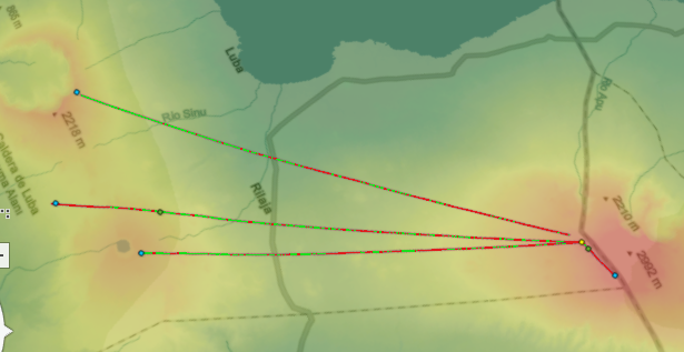
- The result outputted by Line of Sight GP in Arcgis Pro and that's what I want in my WPF app too.
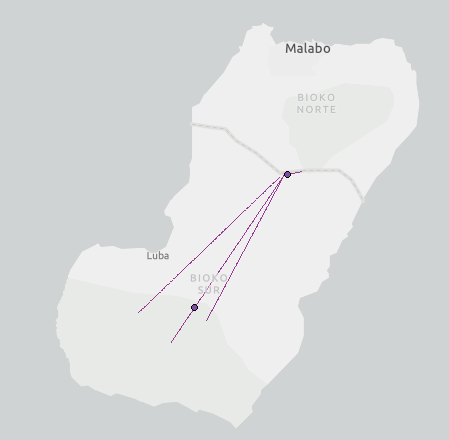
- It's demonstrated result of the Line of Sight Geoprocessing tool of Arcgis Local Server on a map in a WPF App.
1 - The result is an object of "ArcGISMapImageLayer" as you know. Could you please explain me how to Extract the feature class in Arcgis Runtime .NET?
For example; I should learn the obstruction point's coordinate.
2 - If I use the same Geoprocessing Tool in Arcgis Pro. The result would have VisCode which shows the "Visible" line with green color and "Not Visible" line with red color. As you see in the image above, there is just one color that is not specify any meaning in the lines. How to provide the geoprocessing tool in arcgis local server to create the result with VisCode?
Thank you for helping.
Best regards,


