ArcGIS 3.0.2: How does the “service area” of the “network dataset” behave when the facility has no close roads network?
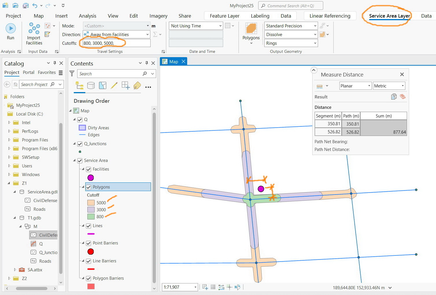
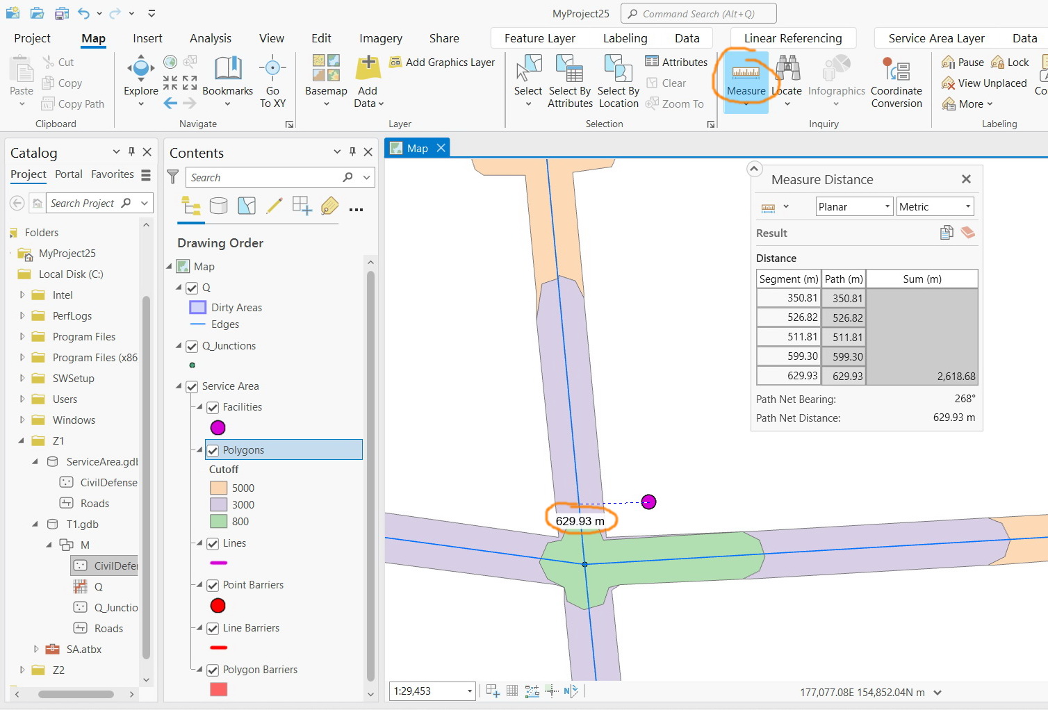
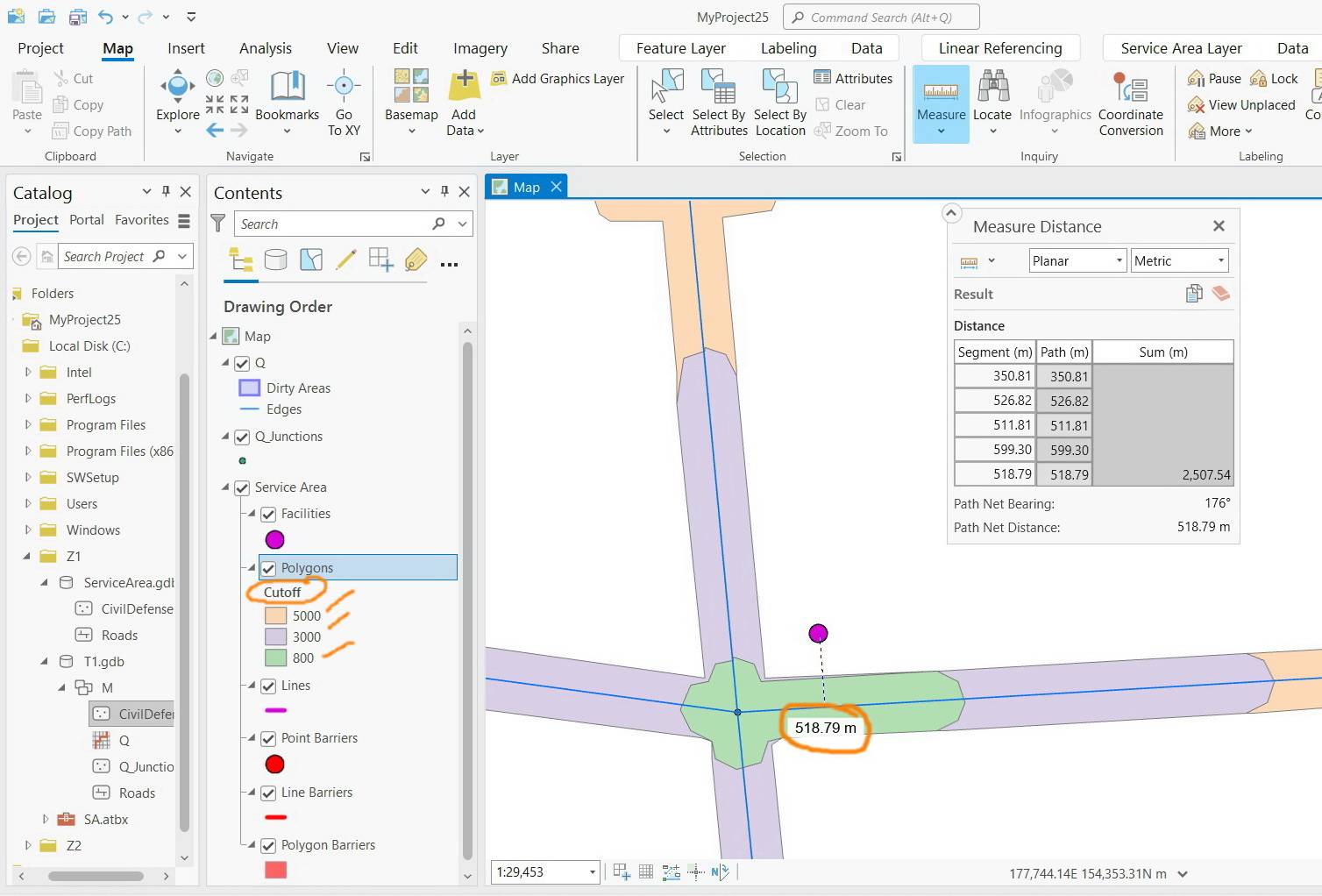
For example, in the network dataset shown in screenshots below, I couldn’t figure out how the “service area” of the “network dataset” behaves while the nearest roads network to the facility is more than 500 meters. Then how the coverage areas of 800, 3000, and 5000 are determined? How the distance is calculated from the facility to the roads particularly where there is no roads network?