Hi
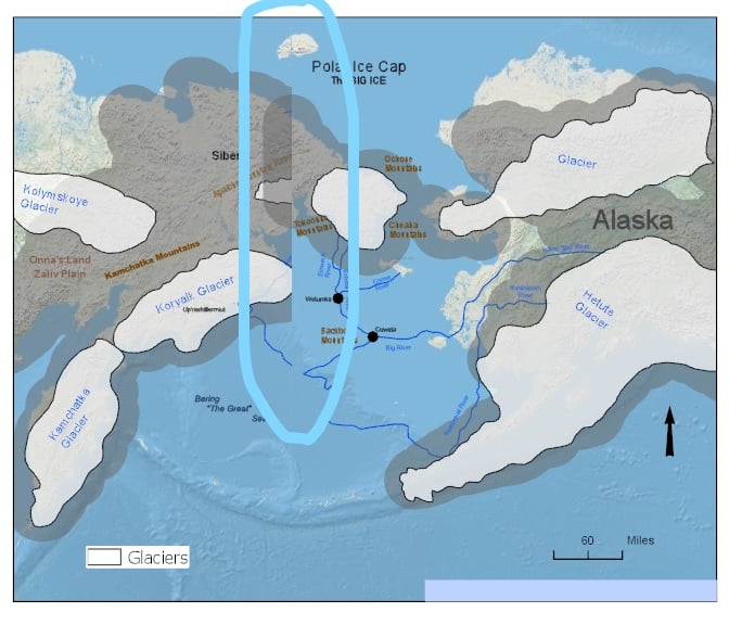
I am working on this map for somebody and I need help to make this line between Far East Russia and Alaska disappear and which projection is the right one to use for this area ?... I am using ArcGIS Pro 2.4 and use the WGS 1984 Web Mercator Auxiliary Sphere ?
I made a map and exported it in PDF, TIFF and PNG in Pro and it came out like this..
Thank you !


