I'm new to ArcGIS Online and am trying to do a fairly easy task with some difficulty. I have imported a .CSV file just containing survey participants Zip Codes. When I import them as addresses/ZIP codes, I can get a heat map of frequency of zip codes (which is what I want), but ArcGIS Online is treating them like singular points (rather than the full area of the Zip Code Boundary). I have also imported the Chicago Zip Codes Boundary zipped shape file.
Do I have to merge these layers or tables somehow? How can I make ArcGIS recognize these zip code frequencies as full zip code areas and not points?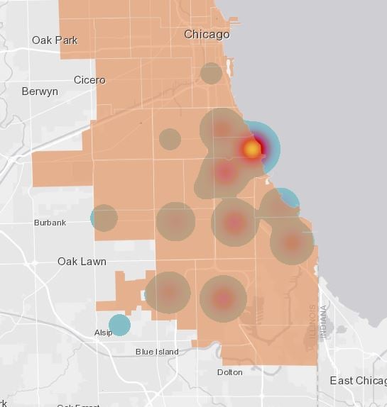
Thanks!