- Created multiple polylines that I identified with the field "Poly_ID"
- Densified the vertices to a 10-foot spacing
- Interpolated the polylines on a DEM raster (3-foot cell resolution)
- Converted the polylines to points
- Created fields "Poly_ID", "X", "Y", and "Z"
- Calculated values for "X", "Y", and "Z"
Goal: Let's say the average number of points for each unique "Poly_ID" is above 1000 but I need to trim it to 500 points.
Question: Aside from starting over with the generalized set of polylines, what process(es) should I utilize that helps me trim the number of points down such that if I were to plot the points before trimming and after trimming on a profile, the differences would be minimal?
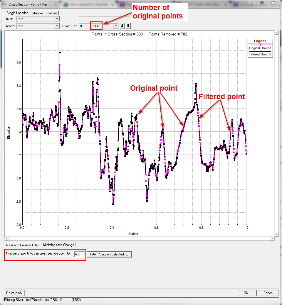
An example of this in HEC-RAS, a non-GIS environment, where you can copy and paste cross-section stationing and elevation, go into tool called "Cross-Section Point Filter" and have the program maintain the integrity of your profile while reducing relatively redundant points.