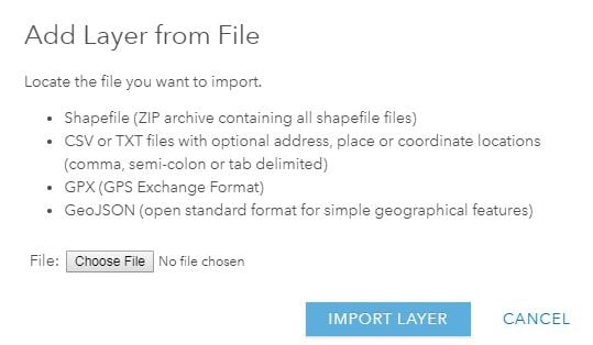
Has anyone broke down the pro's and con's of the different options for adding a layer form file?
With the perspective of a free/public account, the options include:
Zipped Shapefile, .csv or .txt, GPX, GeoJson.
- Zipped Shapefile
this seems to be my default choice but kind of assumes you have a way to create a shapefile and adds extra steps for processing updates. It would be nice option for ArcPRO to export shapefiles directly to zipped folder.
- .csv or .txt
Seems like a great option for creating data from scratch using the provided story-map templates, also good if you're not using desktop software (PRO or other)
- GPX
Seems like the obvious choice if you have data from a GPS, not sure why you would use this otherwise. not even sure you can convert non-gps sourced data to GPX?
- GeoJson
This seems similar .csv/.txt but am unfamiliar so mostly would like a comparison between these two options.
I am looking for which option is the best/easiest for updating data either using online, desktop ESRI, or non ESRI file format.
I am also looking for which option is the best for sharing the data with others, or having the ability to export the data/file from online.
Apologies if this has been covered elsewhere but i could not find any other discussions.
Thanks,
M.Catanzarite
Ann Arbor,MI