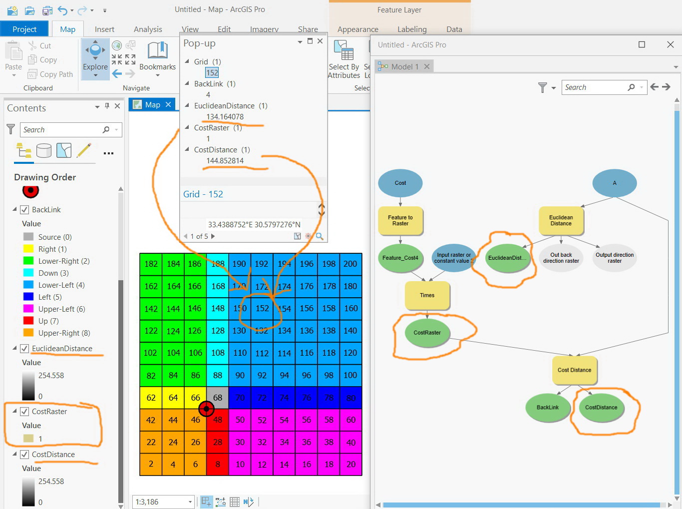
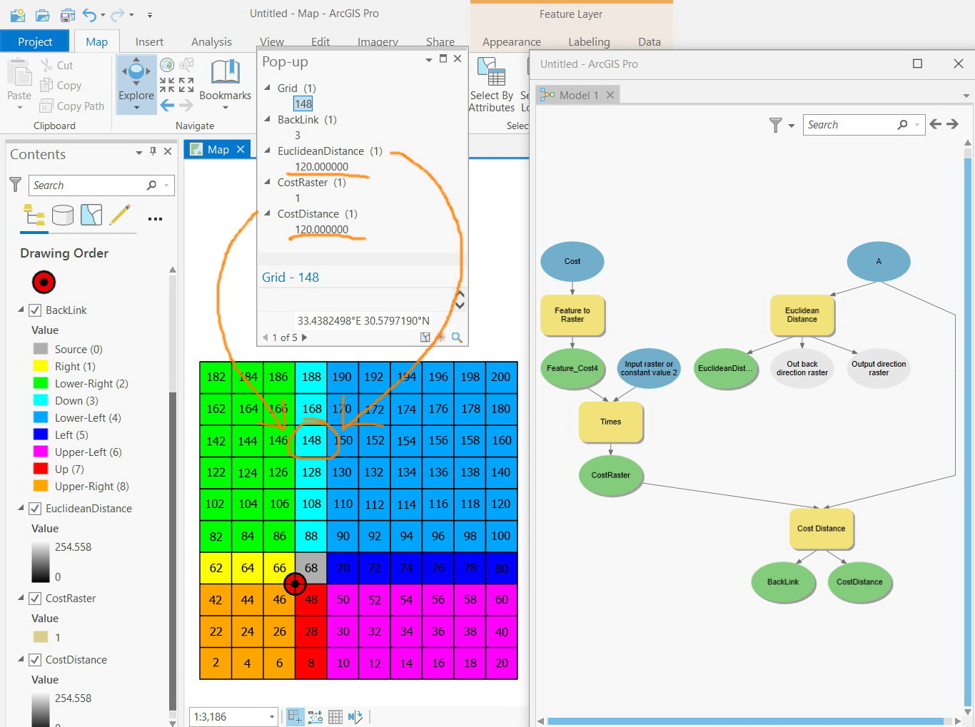
ArcGIS Pro 2.5: What is the mathematical formula based on which the “cost distance” is calculated at any cell?
For example, in the screenshot below, the “cost distance” at the cell number “152” is “144.85”. in return, the value of the “cost distance” at the cell number “148” is “120” which equals the value of “Euclidean distance” at that cell.
What is the mathematical formula based on which the “cost distance” of a cell is derived from “cost raster” and “Euclidean distance” of that cell?
For simplicity, all the cells of “cost raster” is made to have the value one. I observed that the equation below is valid to calculate the “cost distance” at some cells (but not all):
Cost Distance = Cost Raster * Euclidean Distance