Hello,
We are using ArcGIS 10.7 on the project. We are using standard PrintingTools service with standard print templates to provide printing to PDF functionality to the user. This is a print of A4 Landscape. We experience issues with legend on the printing result. The legend is supposed to show symbols for all geometries that are visible for printed extent. However, it shows only limited number of symbols (some of colors visible on the map are missing in the legend), despite there is still a space to add missing entries in the new column. An example of the print is shown below (the grey color is visible on the map, but not in the legend). All geometries are from the same layer.
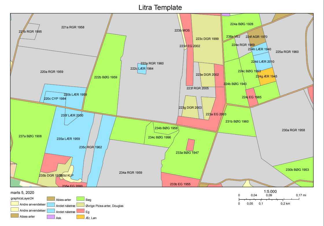
We tried different print settings and considered creating custom template, but there is no option to manipulate the legend, only to specify if it should be there or not and what layers it should contain. Do you know if there is any other way to get all symbols shown correctly in the legend?
Thanks for help in advance.

