We are trying to use segmentation tools in ArcGIS Pro 1.3.1 to classify satellite images.
We followed the two possible ways::
1) accessing from ""Classification tool/ segmentation" in the Raster layer /Data" tab
2) accessing ro "segmentation Mean shift command" in the Spatial Analyst Toolbox
to obtain a segmented image and a vector layed derived from.
Case1
In the first case the preview option shows the segment borders and this is vey usefull to set the proper parameters values (spectral, spatial detail, segment size, bands).
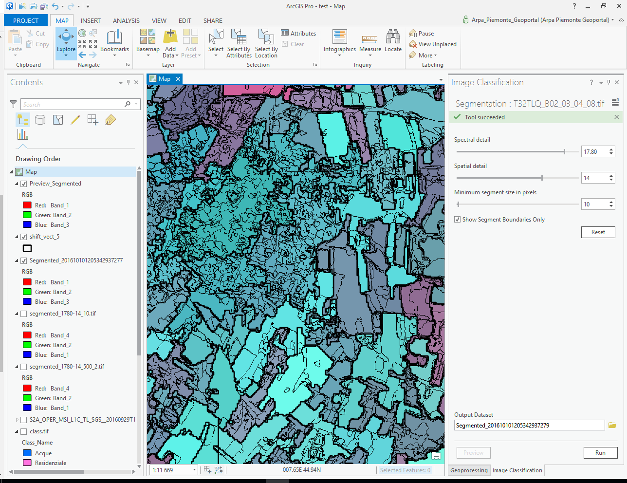
Once you run the tool a segmente image is created but segments are very different from the preview segment borders
Case 2
In the second case (Segment MS in Toolbox)it's not possible to have a preview. but running the tool with the same parameters values you obtain a segmented image similar to the case 1
After, if you run a raster2 vector command the polygons reflects the segmentation but are very different from the preview generated in case 1.
The question are:
1) why preview segment borders are so different from the segmented mean shift images?
2) how to control the segment image details to be like the segment borders shown in the preview?
Thank you
Enrico
Here an example : thin line are segmnent borders from preview (case1) , thicker border are from vectorization from segmented mean shift image (following case 2)