I am about to create a model to do this, but before I go and do that I want to be sure whether this exists already.
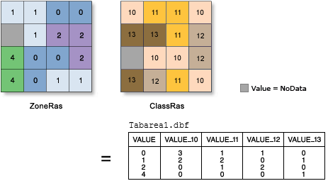
I need to find out the area of each pixel value from a raster within a zone from a polygon overlayed. The closest I have found to this so far is the "zonal statistics" tool in the ESRI Spatial Analyst Toolbox. Ultimately, I would like to join the table to the original polygon zone layer to add these values as attributes of the zone.
Thanks in advance,
Matt Syvertson
msyvertson@co.richland.nd.us