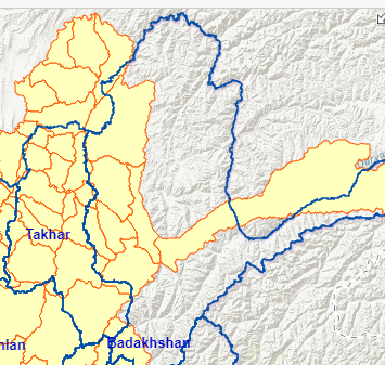
Does anyone recognize this behavior in this ArcGIS On Line map? I haven't given my map anything to drink, I swear! The yellow shaded layer has shifted west by 20 odd miles. The problem will usually fix itself for a while if I zoom or pan. Sometimes the borders will drop in latitude. The problem hasn't occurred yet when I access the map without having signed into my ARC account. I haven't monkeyed with the projection. Thanks for any insight!