Assume I've delineated planar (X, Y) stream breaklines to use them for enforcement of bare ground DEM derivation from high density lidar data (about 1 ground point per square meter or greater). To convert them into 3D breaklines I use a conflation process (InterpolateShape) to populate the Z from the same lidar. Before using them for hydro enforcement in DEM derivation, one needs to see that the vertex elevations decrease monotonically in the downstream direction -due to ground vegetation noise and/or leftover structures in the lidar this is not always the case. Does anybody know of a tool/code to:
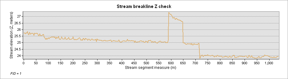
- Check for downstream elevation monotonic decrease? The tool would detect and tag (by feature ID and measure?), polyline segments where the stream deviates from strict downstream gradient. An illustration:
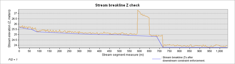
- Enforce the downstream Z monotonicity when errors are found? After enforcement the stream above would look something like:
It seems the functionality exists in the Defense Mapping + Production Mapping extensions (see http://desktop.arcgis.com/en/arcmap/latest/extensions/defense-mapping/correcting-monotonicity-errors.htm), but these are of restricted distribution.
Thanks!
