There is need to be able to draw a polygon/rectangle on the map in order to select intersecting features with that drawing. I can see from the Feature Layer Selection Runtime SDK for .NET example:
The sample uses the MapView.RequestShapeAsync method to allow the user to draw a selection rectangle intersecting features that he would like to manage.Once the selection rectangle is returned, a SpatialQueryFilter is used to spatially select features in the feature layer using FeatureLayer.
Specifically
<SPAN class="keyword token">var</SPAN> rect <SPAN class="operator token">=</SPAN> <SPAN class="keyword token">await</SPAN> MyMapView<SPAN class="punctuation token">.</SPAN>Editor<SPAN class="punctuation token">.</SPAN><SPAN class="token function">RequestShapeAsync</SPAN><SPAN class="punctuation token">(</SPAN>DrawShape<SPAN class="punctuation token">.</SPAN>Rectangle<SPAN class="punctuation token">)</SPAN><SPAN class="punctuation token">;</SPAN><SPAN class="line-numbers-rows"><SPAN></SPAN></SPAN>
I can't find any similar Editor of the MapView for the iOS version of the SDK.
Feature Layer Selection Runtime SDK for iOS example only provides the solution how to select feature by tap point but not by drawing graphics area.
I want to achieve basic functionality as this dashboard provides. User can select features not only by point but also by rectangle, lasso, circle and line. Is there any solution or starting point for this?
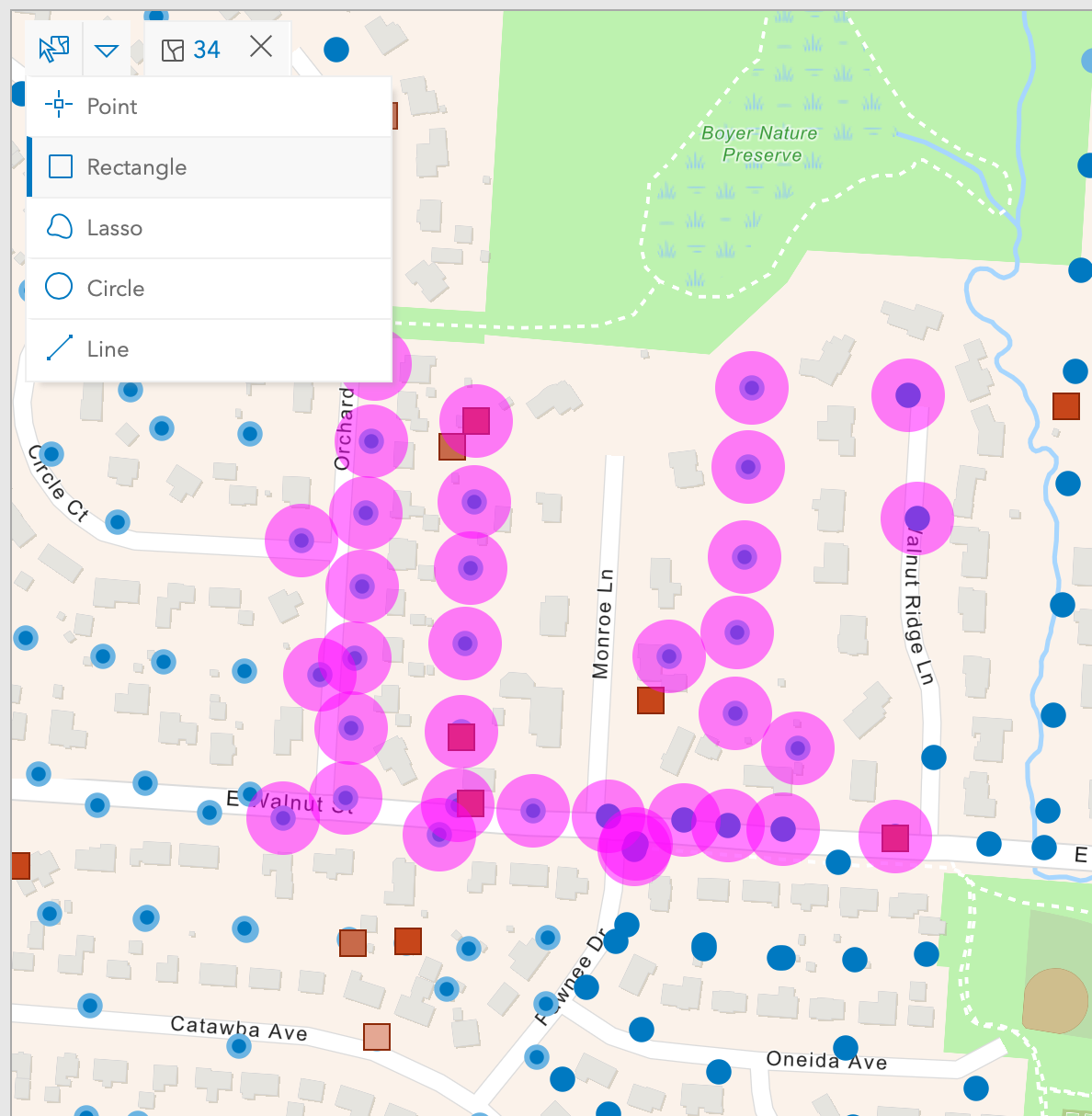
example of selected features by rectangle selection


