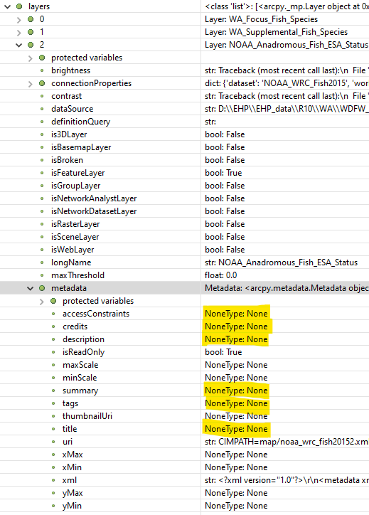
I am trying to access the metadata for a map layer in ArcGIS Pro via arcpy. When I have a map layer, all of its properties from the Pro metadata tab of the layer properties are null. Here is a screenshot of my Python editor when I look at the map layer object in debug mode:
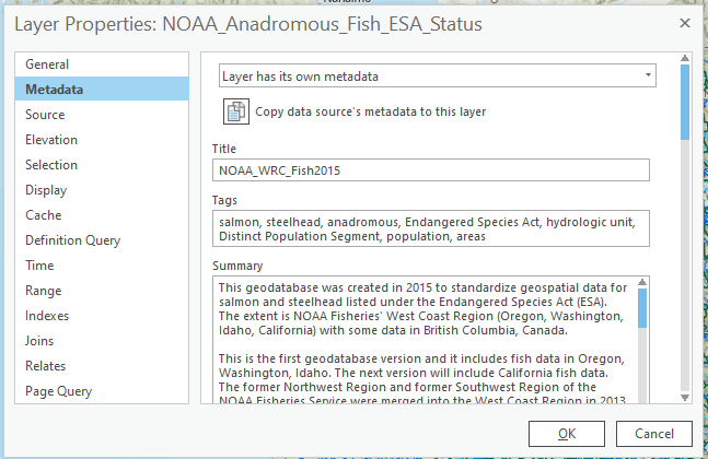
This is a layer that has its own metadata attached to the data source feature class. I copied the metadata to the layer, so it looks like the screenshot below, but I get the same result with null values.
If I go to the feature class (in a file geodatabase), I do get values:
<SPAN class="operator token">>></SPAN><SPAN class="operator token">></SPAN> <SPAN class="keyword token">from</SPAN> arcpy <SPAN class="keyword token">import</SPAN> metadata <SPAN class="keyword token">as</SPAN> md
<SPAN class="operator token">>></SPAN><SPAN class="operator token">></SPAN> tgt_item_md <SPAN class="operator token">=</SPAN> md<SPAN class="punctuation token">.</SPAN>Metadata<SPAN class="punctuation token">(</SPAN>fc_path<SPAN class="punctuation token">)</SPAN>
<SPAN class="operator token">></SPAN> tgt_item_md<SPAN class="punctuation token">.</SPAN>isReadOnly
<SPAN class="token boolean">False</SPAN>
<SPAN class="operator token">>></SPAN><SPAN class="operator token">></SPAN> tgt_item_md<SPAN class="punctuation token">.</SPAN>title
<SPAN class="string token">'NOAA_WRC_Fish2015'</SPAN>
<SPAN class="operator token">>></SPAN><SPAN class="operator token">></SPAN> tgt_item_md<SPAN class="punctuation token">.</SPAN>description
<SPAN class="string token">'<DIV STYLE="text-align:Left;"><DIV><DIV><P><SPAN>The base geospatial information is the Watershed Boundary Dataset (WBD) [...etc...]'</SPAN><SPAN class="line-numbers-rows"><SPAN></SPAN><SPAN></SPAN><SPAN></SPAN><SPAN></SPAN><SPAN></SPAN><SPAN></SPAN><SPAN></SPAN><SPAN></SPAN></SPAN>
Can anyone tell me how to correctly read the metadata from the layer properties metadata tab?
thanks!


