ArcGIS Pro 3.7 Ortho mapping Wizard - I ran my drone data to day to create an Orthomosaic, DTM, and DSM. when they were complete some of the imagery was blacked out (on the higher elevation section) causing a hole in my three layers. I have run three other imagery sets through this same process and did not have these issues, What am I missing?
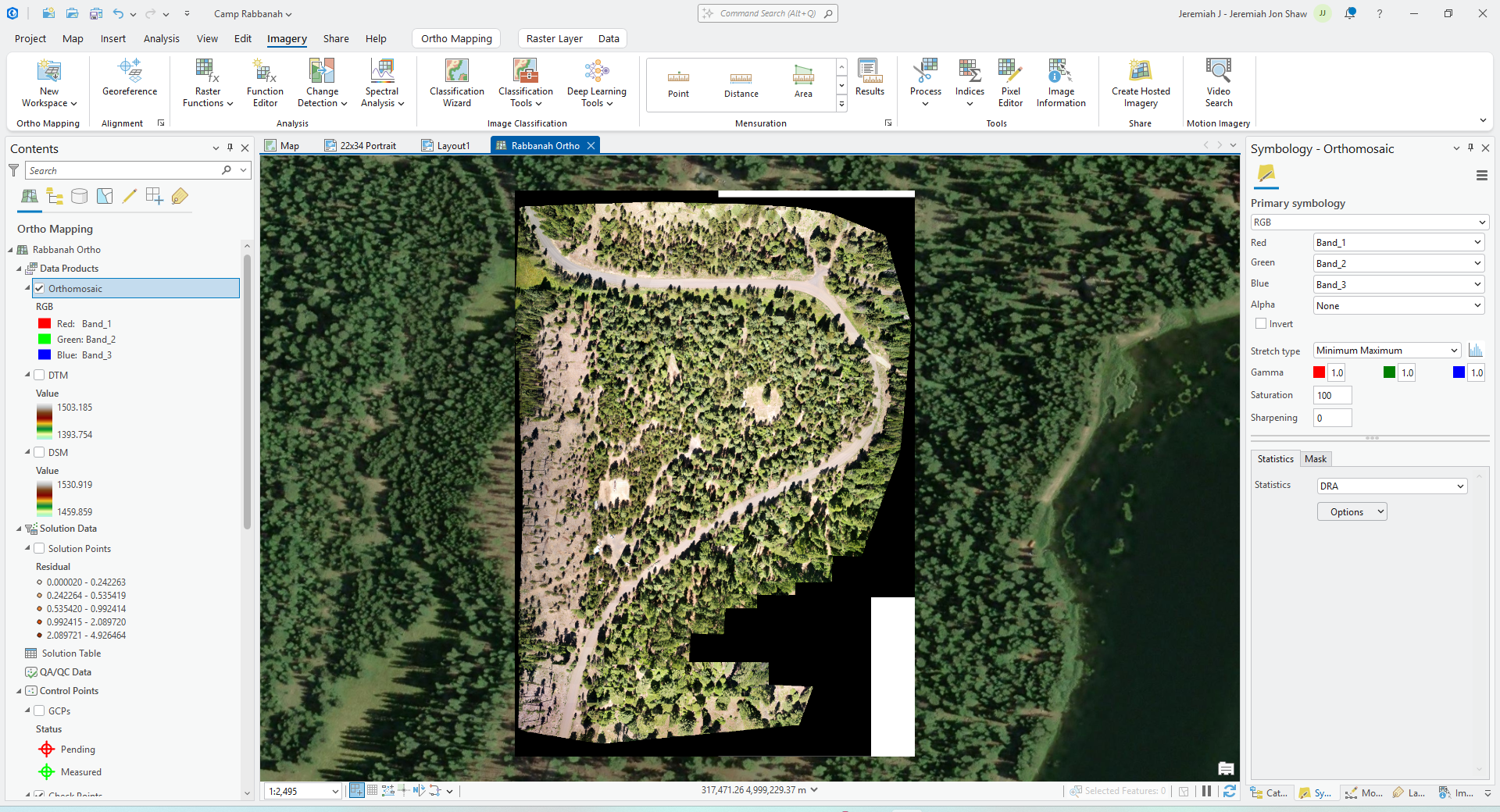
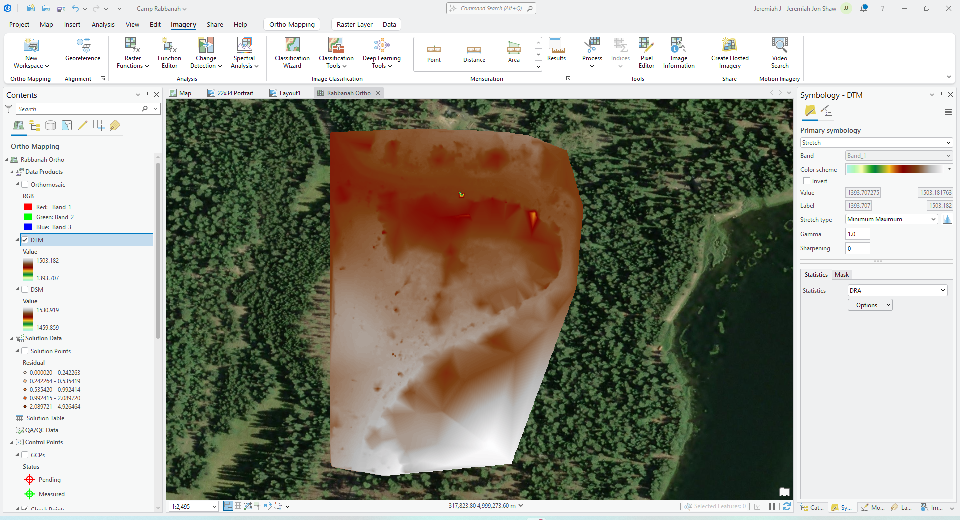
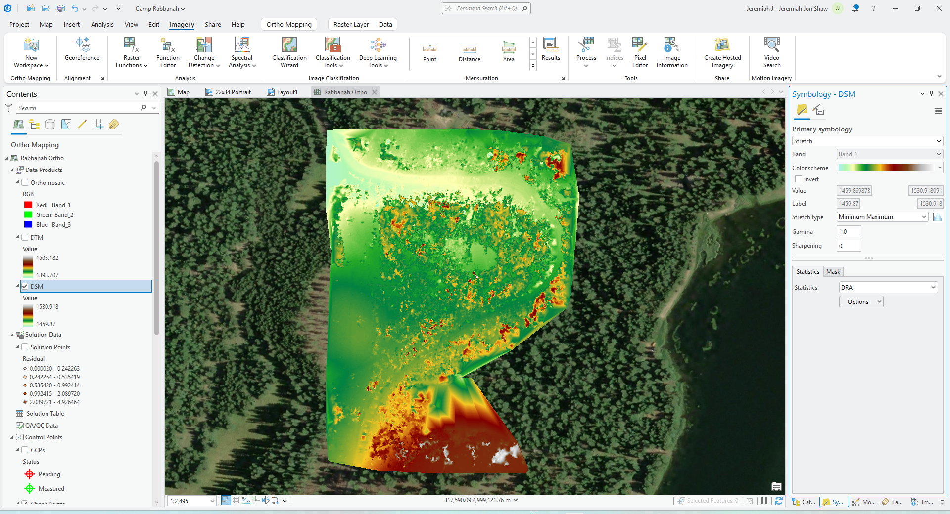
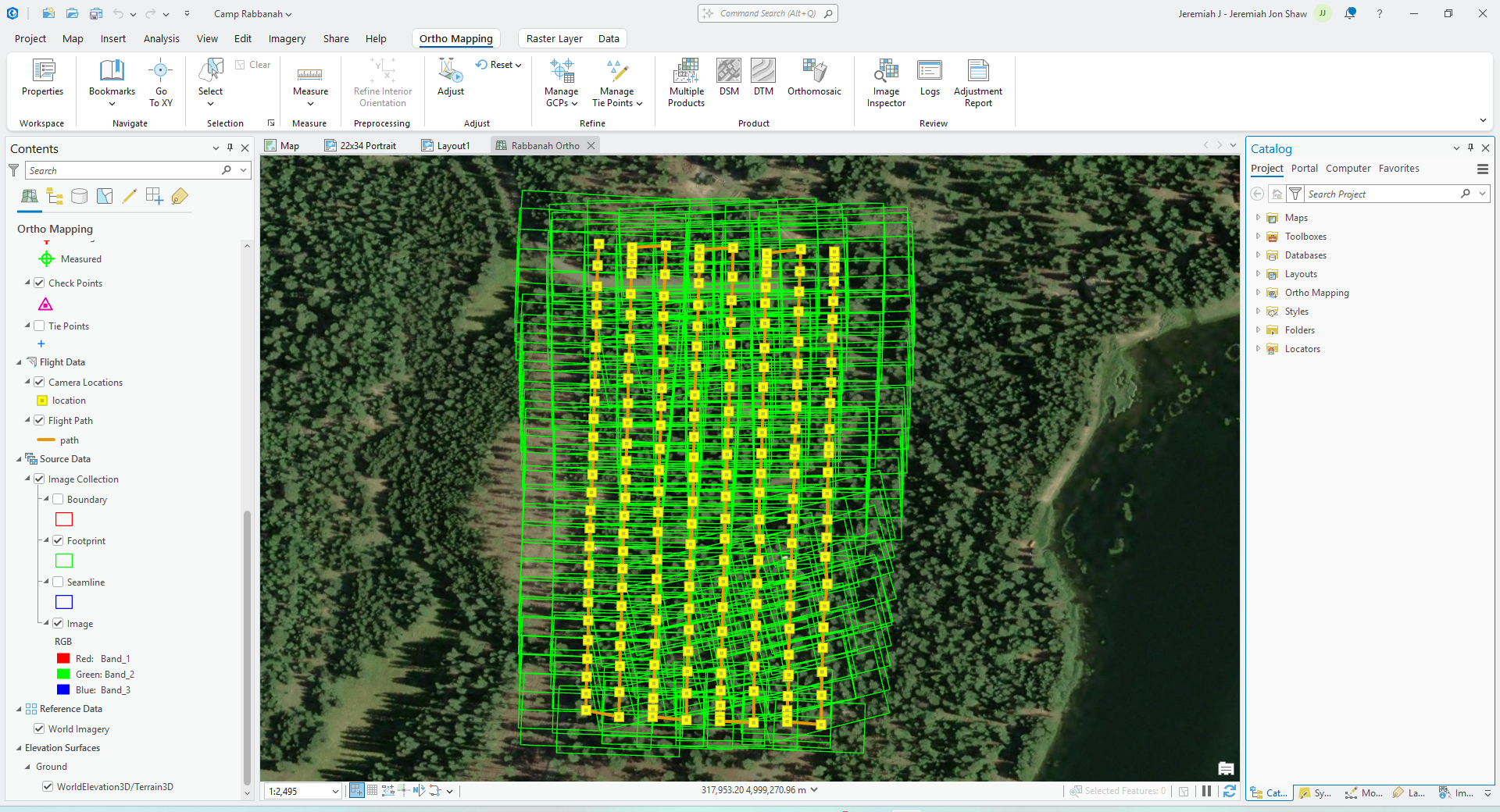
during the block adjustment Process the log stated "41 unsolved images removed" how do I get these to be "solved" any advice will be helpful.




