I've just finished processing a site in Drone2Map and I noticed that the 3D mesh output has produced some issues and was wondering what the best approach is to correct this? During processing I'd already created a course waterbody mask with the following output:
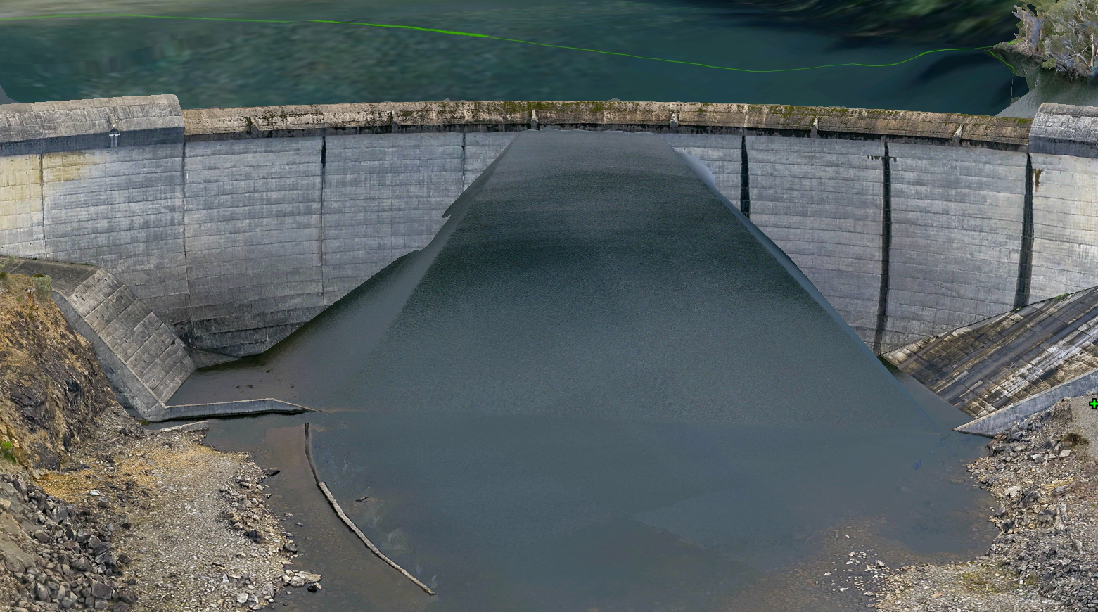
If I create a Correction Feature, like in the following, will it fix this issue?
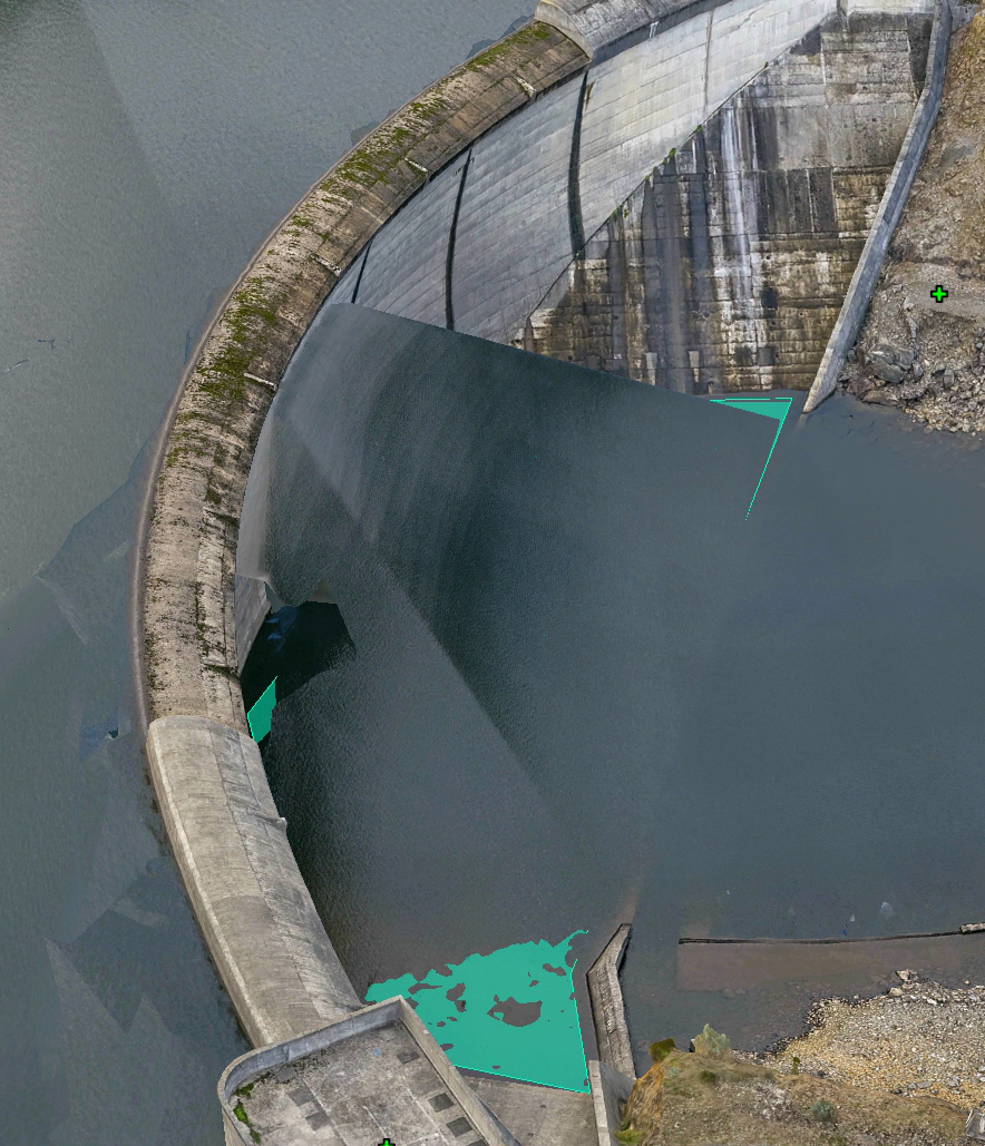
I was also wondering if the correction feature updates the existing model or will it need to produce the whole mesh again? This mesh took 21 hours to process so waiting that long to correct a single issue isn't really practical.
Does Drone2Map support individual image masks? I've put together a small script to automatically generate image masks from user prompts (water, people, skyline, etc) using SAM3 and it would be great if these masks

