
The Esri Innovation Program (EIP) is proud to announce the 2026 Student of Year nominations. EIP encourages students and educators to create innovative applications using ArcGIS technology - as part of research projects, course work, or skills development.
Every year, university members of EIP select one student to be their Student of the Year recipient. A benefit for the nominated student is a cash prize, certificate, and Esri Press book awarded to those who are nominated as Students of the Year.
This Story Map Collection highlights the 2026 projects – thank you to all the students for their inspirational work, and to their mentors for the support and encouragement. Out of all submissions, one student is selected as International Student of the Year and invited to attend the 2026 Esri Education Summit and 2026 Esri User Conference.
This year, this special nomination goes to Jooyoung Yoo, a student from University of Southern California (USC), Recipient of the University of Southern California (USC) EIP Student of the Year nomination.

Congratulations to Jooyoung for his work on his Democratizing Nationwide Urban Tree Canopy Mapping project, showcasing excellent use of GeoAI workflows and imagery to address the ‘shade divide’ – inequality of tree canopy distribution in different neighborhoods and marginalized communities. The project developed a high-accuracy model, which turned out to be a deployable GeoAI infrastructure that can operate directly within a municipality’s GIS environment – to help address these inequalities. A testament to the impact of the project – it was published on Esri Living Atlas as a deep learning package named "Urban Tree Segmentation With NAIP Imagery” and shortly after its release, it recorded over 1,000 downloads in just a week. The project addresses a need and enables reproducible, transferable GeoAI workflows for urban canopy mapping across the United States - helping countless municipalities and researchers worldwide.
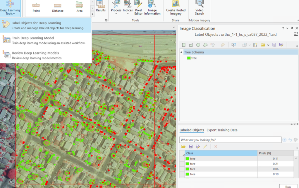
Image: Tree canopy annotation using the Label Objects for Deep Learning tool in ArcGIS Pro.
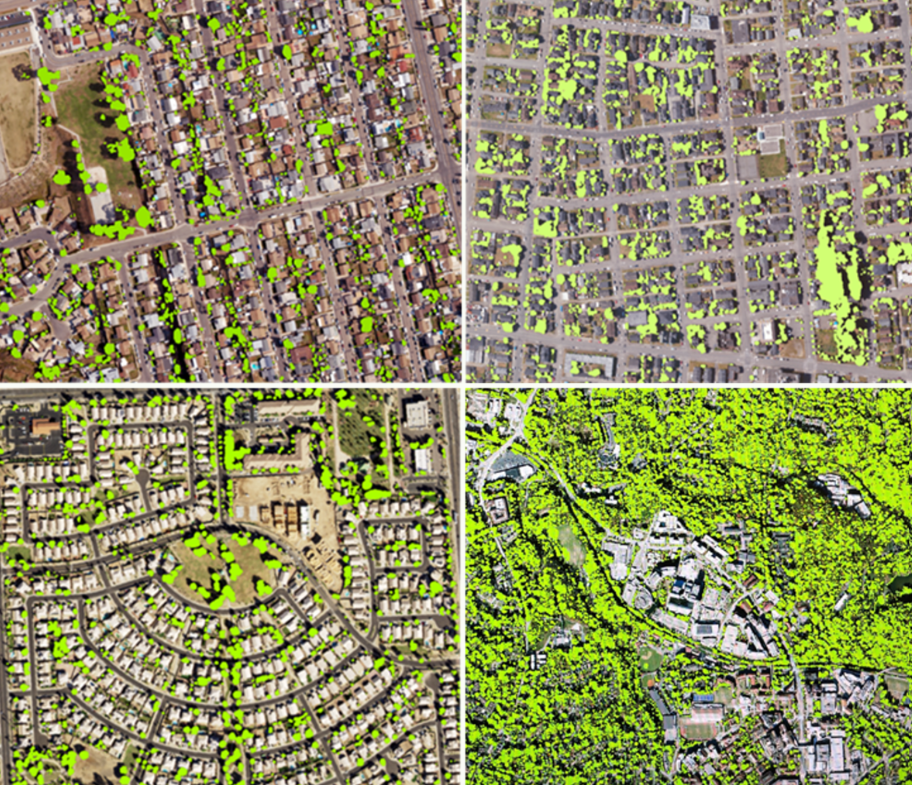
Image: Top row shows San Diego, CA (left) and Eureka, CA (right), and the bottom row shows Phoenix, AZ (left) and Atlanta, GA (right). The bright green polygons represent the model-predicted tree canopy.
Thank you, Jooyoung, for your wonderful work and creativity, and congratulations to all Students of the Year!
